|
|
| Line 79: |
Line 79: |
| |} | | |} |
| ==Clinics== | | ==Clinics== |
| {| {{Prettytable}} class = "sortable" width=75% | | {{Clinic_presentations_header}} |
| !class="top_presentations_col1" {{H13}}| Presented by
| | {{#ask: [[Category:Presentations_DB]][[CSDMS meeting presentation type::Clinic]] |
| !class="top_presentations_col2" {{H13}}| Title
| | | ?CSDMS meeting first name |
| |-
| | | ?CSDMS meeting last name |
| | Irina Overeem
| | | ?CSDMS meeting title presentation |
| | [[CSDMS 2018 annual meeting Irina Overeem | Permafrost Toolbox]]
| | | limit=5000 |
| |-
| | | sort=CSDMS meeting last name |
| | Sediment Experimentalist Network (SEN)
| | | order=ASC |
| | [[CSDMS 2018 annual meeting SEN | Sediment Experimentalist Network (SEN) - Wrangling your research data ]]
| | | template=Presenters_clinics |
| |-
| | | format=template |
| | Guy Schumann and Jeffrey Neal
| | }}</table> |
| | [[CSDMS 2018 annual meeting Guy Schumann and Jeffrey Neal | LISFLOOD-FP Clinic: Introduction to Flood Hazard Modeling ]]
| | <br> |
| |- | |
| | Steve Roberts and Mariela Perignon
| |
| | [[CSDMS 2018 annual meeting Steve Roberts and Mariela Perignon | Hydrodynamic modeling using the open source package ANUGA ]]
| |
| |- | |
| | Mark Piper
| |
| | [[CSDMS 2018 annual meeting Mark Piper | BMI Live! ]]
| |
| |- | |
| | Nicole Gasparini
| |
| | [[CSDMS 2018 annual meeting Nicole Gasparini | Landlab with Hydroshare ]]
| |
| |-
| |
| | Katy Barnhart
| |
| | [[CSDMS 2018 annual meeting Katy Barnhart | Model sensitivity analysis and optimization with Dakota and Landlab ]]
| |
| |- | |
| | Cam Wobus and Mark Lorie | |
| | [[CSDMS 2018 annual meeting Cam Wobus and Mark Lorie | Physical and Socio-Economic Data for Natural Hazards ]]
| |
| |- | |
| | Doug Edmonds and Samapriya Roy | |
| | [[CSDMS 2018 annual meeting Doug Edmonds and Samapriya Roy | An Introduction to using Google Earth Engine]] | |
| |-
| |
| | Ethan Gutmann
| |
| | [[CSDMS 2018 annual meeting Ethan Gutmann | Making Use of Climate Model Output: Downscaling for Regional Applications ]]
| |
| |-
| |
| | Chris Jenkins and Jeff Obelcz
| |
| | [[CSDMS 2018 annual meeting Chris Jenkins and Jeff Obelcz | Forum on Artificial Intelligence & Machine Learning: What lies ahead for Earth Surface Modeling? ]]
| |
| |-
| |
| | Chris Sherwood
| |
| | [[CSDMS 2018 annual meeting Chris Sherwood | How to make accurate digital elevation models using imagery from drones ]]
| |
| |}
| |
|
| |
|
| ==Posters== | | ==Posters== |
Presentations and more of the joined CSDMS - SEN 2018 annual meeting
Geoprocesses, geohazards - CSDMS 2018
May 22-24th 2018 in Boulder Colorado, USA
Thank You
On behalf of CSDMS, we thank the Keynote Speakers, Clinic Leaders, Session Chairs, Poster Session Presenters, members of the Executive and Steering Committees, and every participant who helped to make this a productive and successful meeting. Special thanks to the NSF PREEVENTS program manager Dr. Justin Lawrence for supporting this meeting.
White Paper
We are anticipating to submit the White Paper by end of July, 2018 to meet deadline of the National Academy of Sciences Committee that is just beginning the next decadal survey for the Earth Sciences. If you would like to contribute, please email CSDMS@Colorado.edu with the subject: White Paper no later then June 15th. The white paper will be published later here as well.
Special issue
We are pleased to announce that the open-access EGU journal Natural Hazards and Earth System Sciences (NHESS) will work with us to publish the special issue: Advances in computational modeling of natural and geohazards. We now soliciting contributions for this NHESS special issue.
Agenda
Click here to view the final agenda.
Presentations
Keynote talks
Clinics
| Presenter | Title |
|---|
| Anarde, Katherine |
Parameterizing human dynamics in geomorphic models: learning from coastal barrier evolution models |
| Austermann, Jacky |
Solving the sea level equation: Earth’s response to ice and ocean load changes |
| Baart, Fedor |
Digital Twins in Earth Sciences |
| Balaji, Pavan |
HPCC Clinic I: Introduction to Parallel Programming with MPI (Level I) |
| Bangerth, Wolfgang |
The finite element method (FEM) |
| Banihirwe, Anderson |
Xarray for Scalable Scientific Data Analysis |
| Barnes, Richard |
Using GPUs to Solve Science Problems Faster |
| Barnes, Richard |
A Hands-On Workshop on GPU-Based Landscape Evolution Modeling |
| Barnhart, Katy |
Model sensitivity analysis and optimization with Dakota and Landlab |
| Barnhart, Katy |
Model sensitivity analysis and optimization with Dakota and Landlab |
| Barnhart, Katy |
Model Calibration with Dakota |
| Batchelor, Rebecca |
Inclusive Mentoring |
| Best, Kelsea |
Introduction to agent-based modeling for socio-environmental systems |
| Bhatt, Gopal |
Accessing National Data and Distributed Models for Catchment Simulation |
| Bovy, Benoît |
Building Interactive Dashboards for Earth Surface Processes Modeling with Python and Jupyter |
| Brown, Jed |
Building solvers for sustainable performance |
| Burgess, Peter |
Three carbonate sedimentation models for CSDMS |
| Buscombe, Daniel |
Image Segmentation using Deep Learning and Human-In-the-Loop Machine Learning |
| Buscombe, Daniel |
Part II: Landcover and landform classification using deep neural networks |
| Buscombe, Daniel |
Part I: Landcover and landform classification using deep neural networks |
| Buscombe, Daniel |
Landcover and landform classification using deep neural networks |
| Callaghan, Kerry |
Using Fill-Spill-Merge to understand and analyze landscape depressions |
| Campforts, Benjamin |
Looking Under the Hood: Landscape Evolution Modeling with TerrainBento and Landlab |
| Cheng, Zhen |
Modeling Coastal Sediment Transport Using OpenFOAM® |
| Choi, Eunseo |
SNAC: A 3D parallel explicit finite element code for long-term lithospheric deformation modeling |
| Clow, Gary |
Introduction to the Weather Research & Forecasting (WRF) System, a High-Resolution Atmospheric Model |
| Edmonds, Doug |
An Introduction to using Google Earth Engine |
| Edmonds, Doug |
An Introduction to using Google Earth Engine |
| Eric Barefoot, Andrew Moodie & |
Using the collaborative sandpiper toolchain to support interoperability in geomorphology research |
| Filatova, Tatiana |
Spatial agent-based models: introducing individual interacting actors in environmental models |
| Fleming, Jason |
Real Time ADCIRC Modelling for Coastal Zone Decision Support |
| Gabel, Vanessa |
Clinic 2: Introduction to Landlab: Getting to know the Grid and Coupling Components |
| Gan, Tian |
CSDMS@HydroShare: find, access, operate and couple data-model integration tools for reproducible research |
| Gasparini, Nicole |
Do the work: Building a more equitable research unit |
| Gasparini, Nicole |
Landlab with Hydroshare |
| Gasparini, Nicole |
Modeling the Ecosphere using Landlab |
| Gasparini, Nicole |
Modeling Earth-Surface Dynamics with Landlab 1.0 |
| Gold, Anne |
Building and Maintaining a Diverse and Inclusive Research Team |
| Goodall, Jon |
Integrated Modeling Concepts |
| Gutmann, Ethan |
Making Use of Climate Model Output: Downscaling for Regional Applications |
| Haedrich, Caitlin |
Coastal evolution analysis and inundation modeling with GRASS GIS |
| Haedrich, Caitlin |
An Introduction to GRASS GIS and Tangible Landscape |
| Hamman, Joseph |
Pangeo: Scalable Geoscience Tools in Python — Xarray, Dask, and Jupyter |
| Hariharan, Jayaram |
Rapid hypothesis testing and analysis with the open-source delta model pyDeltaRCM |
| Harris, Courtney |
Regional Ocean Modeling System (ROMS): An introductory web-based model implementation |
| Harris, Courtney |
Regional Ocean Modeling System (ROMS) |
| Hauser, Thomas |
Python for Matlab users clinic |
| Hill, Mary |
MODFLOW: Example applications and what we can learn from this amazingly successful piece of environmental modeling software. |
| Hill, Mary |
Toward Transparent, Refutable Hydrologic Models in Kansas or Oz |
| Hsu, Leslie |
Making your models and data FAIR - Findable, Accessible, Interoperable, and Reusable |
| Hutton, Eric |
Clinic 3: Component Creation with Landlab |
| Hutton, Eric |
Wrapping existing models with the Basic Model Interface |
| Hutton, Eric |
Hands-on with the Python Modeling Toolkit |
| Hutton, Eric |
Part II: Exploring Surface Processes using CSDMS Tools: How to Build Coupled Models |
| Hutton, Eric |
Part I: Exploring Surface Processes using CSDMS Tools: How to Build Coupled Models |
| Hutton, Eric |
BMI: Live! |
| Jagers, Bert |
Morphological modelling using Delft3D Flexible Mesh |
| Jenkins, Chris |
Training Datasets for Modeling with AI across the Deep-Ocean Seafloor |
| Jenkins, Chris |
Forum on Artificial Intelligence & Machine Learning: What lies ahead for Earth Surface Modeling? |
| Jenkins, Chris |
Carbonate Models Clinic - carbo* suite |
| Kazanci, Caner |
Ecological Network Analysis/EcoNet |
| Kim, Wonsuck |
SEN: Take only measurements. Leave only data |
| Koontz, Michael |
An introduction to Google Earth Engine— the planetary-scale GIS for everyone |
| LeVeque, Randall |
Finite Volume Methods for Surface Dynamics Modeling |
| LeVeque, Randy |
GeoClaw Software for Depth Average Flow |
| LeVeque, Randy |
New features and basic usage of the GeoClaw software for depth-averaged flow |
| Lee, Allen |
Good enough practices for reproducible scientific computation |
| Lee, Allen |
Git good with FAIR enough practices for scientific software development |
| Lee, Allen |
The Last FAIR Clinic You'll Ever Need* |
| Lee, Allen |
Get lazy with LLMs |
| Lenard, Sebastien |
How to Route Flow in a Landscape with Landlab? |
| Liao, Chang |
Variable resolution mesh based flow direction and hydrologic modeling: An introduction to HexWatershed |
| Liao, Chang |
Mesh independent flow direction modeling using HexWatershed 3.0 |
| Liu, Xiaofeng |
Modeling of Earth Surface Dynamics and Related Problems using OpenFOAM®. |
| Ludaescher, Bertram |
Publishing Reproducible Computational Research with the Whole Tale |
| Lunacek, Monte |
Interactive Data Analysis with Python |
| Lunacek, Monte |
Interactive Data Analysis with Python (PANDAS) |
| Lyons, Nathan |
Model sensitivity analysis using SALib |
| Madoff, Risa |
Communicating convergent heterogeneous themes in your research |
| Marder, Eyal |
Coupling biological and surface processes in landscape evolution models |
| Martin, Raleigh |
Sediment Experimentalist Network (SEN) - Wrangling your research data |
| Martin, Raleigh |
The Sediment Experimentalist Network (SEN) Knowledge Base |
| Maxwell, Reed |
Beyond Groundwater Modeling: Integrated Simulation of Watershed Systems using ParFlow |
| McDonald, Richard |
An introduction to hydraulic modeling with the Python Modeling Toolkit |
| Meiburg, Eckart |
TURBINS using PETSc |
| Mesehle, Ehab |
Coastal Ecosystem Integrated Compartment Model (ICM): Modeling Framework |
| Mitasova, Helena |
Modeling and analysis of evolving landscapes in GRASS GIS |
| Moodie, Andrew |
Developing and teaching interactive sedimentology and stratigraphy computer activities |
| Moriarty, Julia |
Introduction to Cloud Computing for Geoscientists |
| Mudd, Simon |
LSDtopotools |
| Murray, Brad |
Coastline Evolution Model (CEM) |
| Naliboff, John |
Coupling models of lithospheric deformation and surface processes with the Advanced Solver for Planetary Evolution, Convection, and Tectonics (ASPECT) - Part 2 |
| Naliboff, John |
Coupling models of lithospheric deformation and surface processes with the Advanced Solver for Planetary Evolution, Convection, and Tectonics (ASPECT) - Part 1 |
| Naliboff, John |
Coupling models of lithospheric deformation and surface processes with the Advanced Solver for Problems in Earth's Convection and Tectonics (ASPECT) |
| Olive, Jean-Arthur |
Introduction to coupled geodynamics-surface process modeling with SiStER |
| Over, Jin-Si |
Introduction to Structure-from-Motion Photogrammetry for Mapping Landscapes |
| Overeem, Irina |
Using TopoFlow in the classroom |
| Overeem, Irina |
Permafrost Toolbox |
| Overeem, Irina |
Teaching with Jupyter NoteBooks |
| Overeem, Irina |
Accelerating Glacier and Surface Processes Modeling with Machine Learning and New Python Libraries |
| Overeem, Irina |
Clinic: Using the CSDMS Modeling Tool |
| Overeem, Irina |
Exploring the influence of fault damage and fault slip on the patterns and rates of fluvial incision using CHILD and Matlab |
| Overeem, Irina |
CMT clinic |
| Overeem, Irina |
Modeling Permafrost; a new software toolbox to explore frozen grounds |
| Overeem, Irina |
Bringing CSDMS Models into the Classroom |
| Peckham, Scott |
Geoscience Paper of the Future: Training Session on Best Practices for Publishing Your Research Products |
| Peckham, Scott |
CSDMS Developer Clinic |
| Peckham, Scott |
Introduction to the Basic Model Interface and CSDMS Standard Names |
| Peckham, Scott |
Introduction to the Basic Model Interface and CSDMS Standard Names |
| Peckham, Scott |
Component-based Hydrologic Modeling: Getting Started with the TopoFlow 3.6 Python Package |
| Perez, Fernando |
From Exploration to Publication: Geospatial Research in the Jupyter Ecosystem |
| Perignon, Mariela |
ANUGA - An open-source model of river flood morphodynamics (and other hydrological disasters) |
| Pfeiffer, Allison |
Landlab’s NetworkSedimentTransporter: A Lagrangian model for riverbed material transport dynamics |
| Pierce, Ethan |
Introduction to Landlab |
| Piper, Mark |
BMI Live! |
| Piper, Mark |
WMT and the Dakota iterative systems analysis toolkit |
| Piper, Mark |
WMT: The CSDMS Web Modeling Tool |
| Piper, Mark |
BMI Live! |
| Piper, Mark |
BMI: Live! |
| Piper, Mark |
What can CSDMS do for you?
A clinic on CSDMS Products and Services |
| Pollak, Jon |
Data Access and Publication with the CUAHSI Water Data Center |
| Rajaram, Hari |
A very basic introduction to numerical methods for scientific computing |
| Reniers, Ad |
Dune erosion and overwash with XBeach |
| Roberts, Steve |
Hydrodynamic modeling using the open source package ANUGA |
| Roop, Heidi |
Communication & Engagement: Tips, Tricks, Traps and Opportunities |
| Rossi, Matthew |
Integrating Agent-Based Models into Landlab via pyNetLogo |
| Roth, Danica |
Environmental seismology and distributed acoustic sensing (DAS) |
| Roy, Samapriya |
Introduction & Building with Google Earth Engine: Batteries Included |
| Roy, Sam |
Exploring the influence of fault damage and fault slip on the patterns and rates of fluvial incision using CHILD and Matlab |
| Said, Mohamed Fathi |
Integrating CNN with LSTM Models for Capturing Spatiotemporal Dynamics of Flood Modeling |
| Schumann, Guy |
LISFLOOD-FP Clinic: Introduction to Flood Hazard Modeling |
| Schwenk, Jon |
Exploring river and delta channel networks with RivGraph |
| Shapero, Daniel |
Simulating glacier flow with ICEPACK |
| Sherwood, Chris |
How to make accurate digital elevation models using imagery from drones - or even walking around |
| Signell, Rich |
Emerging open-source Python-based infrastructure for scalable, data-proximate analysis and visualization of model output |
| Sotiropoulos, Fotis |
The SAFL Virtual StreamLab (VSL3D): High Resolution Simulation of Turbulent Flow, Sediment Transport, and Morphodynamics in Waterways |
| Swannack, Todd M. |
Accelerating multidisciplinary environmental research to application: integrating multiple models through mediated modeling |
| Swannack, Todd |
Vegetation as ecogeomorphic features: incorporating vegetation into Earth Surface Models |
| Swartz, John |
Exploring surface processes and landscape connectivity through high-resolution topography: integration of high resolution data in numerical modeling |
| Swiler, Laura |
Dakota: A Toolkit for Sensitivity Analysis, Uncertainty Quantification, and Calibration |
| Thurber, Travis |
Modeling Water Movement and Reservoir Operations with mosartwmpy |
| Tijerina, Daniella |
CUAHSI Services for Hydrologic Modeling and Data |
| Tucker, Greg |
Clinic 1: The Art of Modeling: From Concept to Math with Mass, Energy, and Momentum Balance |
| Tucker, Greg |
Landlab: A Python library for building, exploring, and coupling 2D surface-process models |
| Tucker, Greg |
Creative computing with Landlab: A flexible Python package for rapidly building and exploring 2D surface-dynamics models |
| Tucker, Greg |
Modeling Earth-Surface Dynamics with LandLab |
| Vernon, Chris |
GCAM and Demeter: A global, integrated human-Earth systems perspective to modeling land projections |
| Vernon, Chris |
GCAM and Demeter: A global, integrated human-Earth systems perspective to modeling land projections |
| Vetsch, David |
River morphodynamic modelling across scales using BASEMENT software |
| Volker Grimm, Steve Railsback & |
Pattern-oriented agent-based modeling to achieve structural realism and testable predictions |
| Watts, Joshua |
Agent-Based Modeling Research: Topics, Tools, and Methods |
| Wobus, Cam |
Physical and Socio-Economic Data for Natural Hazards |
| Wu, Wei |
Introduction to R programming and R applications in landscape ecology |
| Yang, Yang |
An Introduction to CUDA-enabled DES3D |
| Zellner, Moira |
Decision Framing |
| Zellner, Moira |
Fora.ai: Reshaping collaboration for climate and social impact |
| Zellner, Moira |
Fora.ai: A participatory modeling platform to reshape how we collaborate for climate and social impact. |
| Zellner, Moira |
Fora.ai: Embedding earth systems modeling in a collaborative framework for innovative, impactful and resilient solution-building |
| Zellner, Moira |
Fora.ai: A participatory modeling platform to reshape how we collaborate for climate and social impact |
| Zhou, Zheyu |
Modeling coastal processes using OpenFOAM |
| de Mutsert, Kim |
Introduction to Ecopath with Ecosim |
| de Mutsert, Kim |
Introduction to EcoPath with Ecosim |
Posters
| Name | Abstract title | Poster |
|---|
| Antolini, Federico |
A framework proposal for spatial distribution of small reservoirs |  |
| Ashley, Thomas |
Statistical Bedload Modeling on the Colorado River in Grand Canyon National Park |  |
| Barnes, Richard |
Efficient Parallel Algorithms For Terrain Analysis |  |
| Best, Kelsea |
Machine Learning to Identify Drivers of Internal Migration in Coastal Bangladesh | 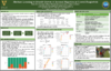 |
| Best, Üwe |
Modelling Wave Action, Surges, Morphodynamics and Vegetation Dynamics: Do Salt Marsh & Mangrove Fringe Coastlines Survive Sea Level Rise? | 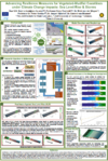 |
| Calhoun, Donna |
ForestClaw : A parallel, adaptive Cartesian grid library for problems in geophysical hazards modeling | 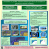 |
| Callaghan, Kerry |
Coupled groundwater and surface water modelling to visualise lake extent and total terrestrial water storage under a changing climate | 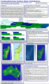 |
| Campforts, Benjamin |
Landslides in long term landscape evolution models | |
| Chadwick, Austin |
Predicting the location of avulsion hazards on deltas in the face of changing discharge regimes and relative sea-level rise | 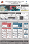 |
| Chen, Yunxiang |
conduitFoam: a one-dimensional subglacial conduit mode |  |
| Ciarletta, Daniel |
Long Term Risks: Novel Barrier Island Retreat Behaviors Arising from Increasing Rates of Sea Level Rise | 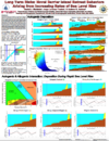 |
| Cohen, Sagy |
The Floodwater Depth Estimation Tool (FwDET) | 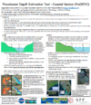 |
| Davis, Brisa |
Targeted Adaptive Mesh Refinement for Tsunami Modeling Using Adjoint Equations | 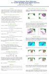 |
| Del Vecchio, Joanmarie |
Using relict Pleistocene geomorphology to inform future permafrost change | |
| Duan, Jennifer |
Impact of Climate Change on Flood Frequency Curve: Santa Cruz River Case Study |  |
| Ferdowsi, Behrooz |
Glassy dynamics of landscape evolution | 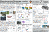 |
| Ferrier, Ken |
Transient relationships between chemical and physical erosion rates in regolith-mantled topography | |
| Glade, Rachel |
Modeling the 2-D evolution of blocky landscapes: Coupled model design | 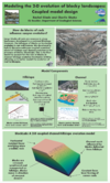 |
| Hoffimann, Julio |
ImageQuilting.jl: A code for generating 3D stratigraphy from data collected in flume experiments | |
| Istanbulluoglu, Erkan |
A hydroclimatological approach to predicting regional landslide probability using Landlab | 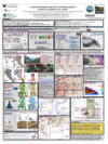 |
| Janoff, Arye |
A Coastal Geo-economic Model: Property Protection, Federal Buyouts, and Managed Retreat | 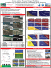 |
| Kochanski, Kelly |
Statistical classification of self-organized snow surfaces | 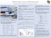 |
| Kolodin, Jesse |
Investigating Artificial Berm-Dune Management Along New Jersey’s Coastline Using a Coupled Geo-Economic Model | 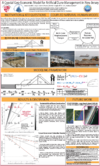 |
| Kozlowski, Estanislao |
Multi-scale modelling of microbial lacustrine carbonates with Carbo-CAT and Mounds3D | |
| Leonarduzzi, Elena |
Towards a landslide warning concept for Switzerland using rainfall thresholds and multi-scale hydrological modeling | |
| Li, Jin |
Influence of wave-induced currents on sediment transport and coral growth of atolls | |
| Li, Jiao |
Embedding Seawall Models in Coastal Flooding Simulations | |
| Lyons, Nathan |
Coupled models of landscape and species evolution | |
| Morris, Chloe |
The Coastline Evolution Model 2D (CEM2D) | |
| Nienhuis, Jaap |
Can barrier islands survive sea level rise? Tidal inlets versus storm overwash | 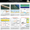 |
| Obelcz, Jeffrey |
Towards a Quantitative Understanding of Parameters Driving Submarine Slope Failure: A Data Mining and Machine Learning Approach | 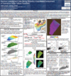 |
| Pfeiffer, Allison |
How do source-to-sink geomorphic processes mediate flood hazards? Using historical changes to inform predictions | |
| Phillips, Colin |
Coupling fine particle transport, storage, and remobilization with sediment bed morphodynamics | 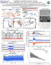 |
| Pérez-Hincapié, Ana María |
Comparative geomorphological analysis applied to the hazard assessment of debris flows in three watersheds of the Western Cordillera of Colombia |  |
| Qin, Xinsheng |
Accelerating Block-Structured Adaptive Mesh Refinement (AMR) with GPUs | 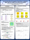 |
| Qureshi, Huda |
A Sensitivity Analysis of the Effect of Parametric Wind Model Inputs on Hurricane Storm Surge Simulations | |
| Richmond, Nick |
3D Bedrock Channel Evolution with Smoothed Particle Hydrodynamics Coupled to a Finite Element Earth | 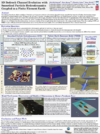 |
| Schumann, Guy |
Integrating EO Data of Floods with a Hydrodynamic Event Model: Harvey 2017 | 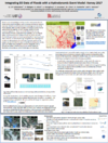 |
| Shobe, Charles |
Modeling the 2-D evolution of blocky landscapes: Hillslope-channel interactions | 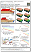 |
| Sincavage, Ryan |
Deterioration of the eastern margin of the Colonia Glacier, northern Patagonia: the end of a glacially-dammed alpine lake? | |
| Southard, Paul |
Impact of spring-associated riparian vegetation on channel morphology in ephemeral dryland channels: Henry Mountains, Utah, USA | |
| Strom, Kyle |
A simple, single-size and time-dependent flocculation model |  |
| Tang, Hui |
Physics-informed machine learning approach for predicting post-fire debris flows based on thresholds | |
| Wang, Kang |
Effect of Enhanced Cold-Season Climate Warming on Permafrost Temperatures | 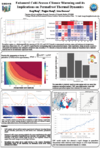 |
| Wickert, Andrew |
Long-profile evolution of transport-limited gravel-bed rivers | |
| Yanites, Brian |
Quantitative constraints on landslide frequency through the use of cosmogenic nuclides: a numerical modeling perspective | |
Meeting photos


