CSDMS meeting 2018: Difference between revisions
From CSDMS
No edit summary |
No edit summary |
||
| Line 7: | Line 7: | ||
{{TOC right}} | {{TOC right}} | ||
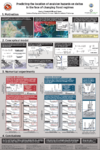
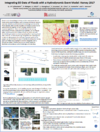
<br>[[image:Limpopo3a.jpg|400px]]<br><br> | <br>[[image:Limpopo3a.jpg|400px]]<br><br> | ||
<!-- | |||
=Thank You= | =Thank You= | ||
On behalf of CSDMS, we thank the Keynote Speakers, Clinic Leaders, Session Chairs, Poster Session Presenters, members of the Executive and Steering Committees, and every participant who helped to make this a productive and successful meeting.<br> | On behalf of CSDMS, we thank the Keynote Speakers, Clinic Leaders, Session Chairs, Poster Session Presenters, members of the Executive and Steering Committees, and every participant who helped to make this a productive and successful meeting.<br><br> | ||
--> | |||
=Agenda= | =Agenda= | ||
Click [[Media:CSDMS2018FinalAgenda.pdf|here]] to view the final agenda | Click [[Media:CSDMS2018FinalAgenda.pdf|here]] to view the final agenda | ||
Revision as of 20:11, 13 May 2018
Geoprocesses, geohazards - CSDMS 2018
May 22-24th 2018 in Boulder Colorado, USA

Agenda
Click here to view the final agenda
Presentations
Keynote talks
Clinics
| Presented by | Title |
|---|---|
| Irina Overeem | Permafrost Toolbox |
| Sediment Experimentalist Network (SEN) | Sediment Experimentalist Network (SEN) - Wrangling your research data |
| Guy Schumann and Jeffrey Neal | LISFLOOD-FP Clinic: Introduction to Flood Hazard Modeling |
| Steve Roberts and Mariela Perignon | Hydrodynamic modeling using the open source package ANUGA |
| Mark Piper | BMI Live! |
| Nicole Gasparini | Landlab with Hydroshare |
| Katy Barnhart | Model sensitivity analysis and optimization with Dakota and Landlab |
| Cam Wobus and Mark Lorie | Physical and Socio-Economic Data for Natural Hazards |
| Doug Edmonds and Samapriya Roy | An Introduction to using Google Earth Engine |
| Ethan Gutmann | Making Use of Climate Model Output: Downscaling for Regional Applications |
| Chris Jenkins and Jeff Obelcz | Forum on Artificial Intelligence & Machine Learning: What lies ahead for Earth Surface Modeling? |
| Chris Sherwood | How to make accurate digital elevation models using imagery from drones |
Posters