|
|
| (8 intermediate revisions by the same user not shown) |
| Line 1: |
Line 1: |
| ===Topography data=== | | === Topography data descriptions === |
| | ''This is an automatically generated table''. |
|
| |
|
| * '''LiDAR / ALSM''' (Airborne Laser Swath Mapping)<br>[http://www.ncalm.org/ Original data source] | [http://calm.geo.berkeley.edu/ncalm/index.html Download data]
| | Want to '''add your dataset''' to this list? Please complete this [[Form:Input_data|data form]] first. Feel free to contact us [mailto:CSDMSweb@colorado.edu CSDMSweb@colorado.edu] or use the wiki and follow one of the dataset links if you want to update the information about a dataset that is already listed. |
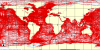
| * '''ETOPO2''' (Global 2-minute gridded elevation data)<br>[http://www.ngdc.noaa.gov/mgg/fliers/01mgg04.html Original data source] | [http://www.ngdc.noaa.gov/mgg/global/relief/ETOPO2/ETOPO2v2-2006/ Download data]
| | |
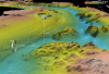
| * '''ETOPO5''' (Global 5-minute gridded elevation data)<br>
| | There are '''{{#ask: [[Data:+]] [[Data type::Topography]] |
| {| class="wikitable collapsible collapsed"
| | | sort=Data origin |
| ! class=""| Data description
| | | format=count |
| ! class=""| [http://www.ngdc.noaa.gov/mgg/global/etopo5.HTML Original data source]
| | }}''' datasets described below. |
| ! class=""| [http://www.ngdc.noaa.gov/mgg/global/relief/ETOPO5/ Download data]
| | |
| |-
| | <table {{Prettytable}} class = "sortable" cellspacing="0" cellpadding="0" style="margin:0em 0em 0em 0;"> |
| ! class="" colspan="3" | Data description
| | <tr><th {{H13}}>Dataset info</th><th {{H13}}>Type</th><th {{H13}}>Origin</th><th {{H13}}>Description</th><th {{H13}}>Data example</th></tr> |
| |-
| | {{#ask: [[Data:+]] [[Data type::Topography]] |
| | class="" colspan="3"| ETOPO5 (Earth Topography 5-minute) is a gridded elevation (land) and bathymetry (sea floor) data set for the entire Earth at a grid spacing of 5 minutes (1/12 of a degree or 300 arcseconds). The entire data set consists of a single file which has 4320 columns and 2160 rows. This data set was compiled using data from many different sources by the National Geophysical Data Center (NGDC), which is part of the National Oceanic and Atmospheric Administration (NOAA). Most of the data set dates to 1988, except for a small area in Canada that was regridded in 1990. Elevation values are stored in a flat binary file (row major, no header) as signed 2-byte integers, and are available with both the LSB (least significant byte first) and MSB (most significant byte first) byte orders. The elevation units are meters.<br>Note - The newer GLOBE and GTOPO30 data sets (See below) also provide global coverage at the much higher resolution of 30 arcseconds.<br>''This description is provided by Rivix LLC''
| | | ?Data type |
| |}
| | | ?One-line data description |
| * '''GLOBE''' (Global Land One-km Base Elevation)<br>
| | | ?Data download link |
| {| class="wikitable collapsible collapsed" | | | ?Upload image dataset |
| ! class=""| Data description
| | | ?Data origin |
| ! class=""| [http://www.ngdc.noaa.gov/mgg/topo/globe.html Original data source]
| | | limit=5000 |
| ! class=""| [http://www.ngdc.noaa.gov/mgg/topo/gltiles.html Download data]
| | | format=template |
| |- | | | template=ask data template |
| ! class="" colspan="3" | Data description
| | }}</table> |
| |- | |
| | class="" colspan="3"| GLOBE is an international effort to create a global digital elevation model (DEM) on a nominal 1-kilometer grid. Data from a variety of sources was compiled and independently peer-reviewed to provide 30 arcsecond grid spacing, which corresponds to approximately one kilometer near the equator. GLOBE Version 1.0 was completed and released in 1999. GLOBE is an activity of the Committee on Earth Observation Satellites (CEOS), and is part of Focus 1 of the International Geosphere-Biosphere Programme's Data and Information System (IGBP-DIS).<br>GLOBE coverage is divided into sixteen tiles. Each tile spans 90 degrees of longitude has 10800 columns. Tiles bordering the equator span 50 degrees of latitude and have 6000 rows, while the remaining tiles span 40 degrees and have 4800 rows. Elevation data is stored as signed 2-byte integers in flat binary (row major) files with the LSB (least significant byte first) byte order and units of meters. Header files for several formats are also available. Bathymetric data is not yet included but is planned for a future version of GLOBE.<br>''This description is provided by Rivix LLC''
| |
| |}
| |
| * '''GTOPO30''' (Global 30 Arc-Second Elevation Data Set)<br>
| |
| {| class="wikitable collapsible collapsed" | |
| ! class=""| Data description
| |
| ! class=""| [http://edc.usgs.gov/products/elevation/gtopo30/gtopo30.html Original data source]
| |
| ! class=""| [http://edc.usgs.gov/products/elevation/gtopo30/gtopo30.html Download data]
| |
| |-
| |
| ! class="" colspan="3" | Data description
| |
| |-
| |
| | class="" colspan="3"| GTOPO30 is a global digital elevation model (DEM) with a horizontal grid spacing of 30 arcseconds (about 1 kilometer at the equator). GTOPO30 was developed through a collaborative effort led by staff at the USGS EROS Data Center. NASA and several other organizations around the world contributed to the project, which was completed in late 1996. The data set provides complete global coverage divided into 33 tiles. Ocean pixels are flagged with a nodata value of -9999.<br>For latitudes between -60 and 90 degrees there are 27 tiles, each spanning 50 degrees of latitude (6000 rows) and 40 degrees of longitude (4800 columns). Latitudes between -90 and -60 correspond to Antarctica, which is covered by 6 tiles, each spanning 30 degrees of latitude (3600 rows) and 60 degrees of longitude (7200 columns). The data for Antarctica is also available in a polar stereographic projection consisting of a single tile that has 5400 columns and 5400 rows and a grid spacing of 1000 meters. Elevation data for all tiles is stored as signed 2-byte integers in flat binary (row major, no header) files with the MSB (most significant byte first) byte order and units of meters above mean sea level. Georeferencing information is in a separate ASCII header (HDR) file. The reference ellipsoid/datum is WGS84.<br>''This description is provided by Rivix LLC''
| |
| |}
| |
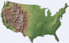
| * '''NED''' (National Elevation Dataset; USA)<br>
| |
| {| class="wikitable collapsible collapsed" | |
| ! class=""| Data description
| |
| ! class=""| [http://ned.usgs.gov/ Original data source]
| |
| ! class=""| [http://seamless.usgs.gov/ Download data]
| |
| |-
| |
| ! class="" colspan="3" | Data description
| |
| |-
| |
| | class="" colspan="3"| The National Elevation Dataset (NED) is a new raster product assembled by the US Geological Survey (USGS) from several other US data sets. It is designed to provide elevation data for the United States in a seamless form with a consistent datum, elevation unit, and projection. The NED has a horizontal resolution of 1 arcsecond (approximately 30 meters at the equator) for the conterminous US, Hawaii, and Puerto Rico, and 2 arcseconds for Alaska. Actual pixel dimensions in meters vary with the cosine of latitude. Since most of Alaska is north of 60 degrees latitude, and since cos(60)=1/2, pixel dimensions in Alaska are also close to 30 meters. Elevation units are decimal meters. North American Datum 1983 (GRS 80 ellipsoid) is used as the horizontal datum, and the data is in the Geographic "projection". The NED is nearing completion and will be distributed in the Spatial Data Transfer Standard (SDTS) Raster Profile format. The NED will be updated to incorporate data of higher resolution or quality as it becomes available.<br>During the NED assembly process, source data was corrected when necessary to minimize artifacts and to provide better edge matching near seams between adjacent source DEMs. The source data included USGS 7.5-minute DEMs (UTM, 30 meter pixels) for which edge matching problems are not uncommon.<br>''This description is provided by Rivix LLC''
| |
| |}
| |
| * '''SLA-02''' (Shuttle Laser Altimeter III)<br>[http://denali.gsfc.nasa.gov/sla02/ Original data source] | [http://denali.gsfc.nasa.gov/lapf_web/claudia/data/data_download.html Download data]
| |
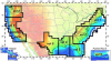
| * '''SRTM''' (Shuttle Radar Topography Mission)
| |
| {| class="wikitable collapsible collapsed"
| |
| ! class=""| Data description
| |
| ! class=""| [http://www2.jpl.nasa.gov/srtm/ Original data source]
| |
| ! class=""| [ftp://e0srp01u.ecs.nasa.gov/ Download data]
| |
| |- | |
| ! class="" colspan="3" | Data description
| |
| |- | |
| | class="" colspan="3"| The Shuttle Radar Topography Mission (SRTM) was a 10-day mission which flew on the Space Shuttle Endeavour in February 2000. It was a cooperative project between NASA and the National Imagery and Mapping Agency (NIMA, formerly Defense Mapping Agency) that collected high-resolution topographic data for most of the land surfaces between -54 and 60 degrees latitude. Data was collected using a method called single-pass radar interferometry, with two imaging radar systems on the Shuttle separated by a 60 meter mast. This technology is based on the Spaceborne Imaging Radar - C/X-Band Synthetic Aperture Radar (SIR-C/X-SAR) that was used on two previous Shuttle missions.<br>Although the data collection effort has been completed, the post-processing and validation necessary to produce a final gridded data set is scheduled to be complete sometime in 2004. As of June, data for North and South America, Eurasia and Africa have been made available on an FTP site (see link below) in a simple, binary "HGT" format as 2-byte integers. The final data set is to be delivered to the EROS Data Center (EDC) of the USGS for distribution, possibly in the SDTS Raster Profile format. For latitudes between -50 and 50, the grid spacing will be 1 arcsecond of latitude and longitude (about 30 meters at the equator and decreasing towards the poles). For latitudes between -54 and 50 and between 50 and 60, the grid spacing will be 1 arcsecond of latitude and 2 arcseconds of longitude. Each tile in the data set will span 5 degrees of latitude and 5 degrees of longitude. For the region between -50 and 50, each tile will then contain 18000 rows and 18000 columns. Elevations will be measured in meters relative to the WGS84 ellipsoid model.<br>''This description is provided by Rivix LLC'' | |
| |}
| |