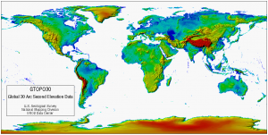
Data:GTOPO30
From CSDMS
GTOPO30 dataset information page
Short Description
 |
| GTOPO30 global digital elevation model |
Statement: GTOPO30 is a global digital elevation model with a horizontal resolution of 30 arc seconds.
Abstract: GTOPO30 is a global digital elevation model (DEM) with a horizontal grid spacing of 30 arc seconds (approximately 1 kilometer). GTOPO30 was derived from several raster and vector sources of topographic information.
Data format
| Data type: | Topography |
| Data origin: | Modeled |
| Data format: | BIL |
| Other format: | |
| Data resolution: | 30 arc second (~1km) |
| Datum: | The reference ellipsoid/datum is WGS84 |
Data Coverage
Spatial data coverage: Global
Temporal data coverage: Time snap shot
Time period covered: completed in 1996
Availability
Download data: http://eros.usgs.gov/#/Find Data/Products and Data Available/gtopo30 info
Data source: http://eros.usgs.gov/#/Find Data/Products and Data Available/gtopo30 info
