Data:GSHHG
GSHHG dataset information page
Short Description
 |
| Global Self-consistent, Hierarchical, High-resolution Geography Database |
Statement:
Global Self-consistent, Hierarchical,
High-resolution Geography Database
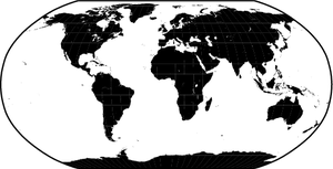
Abstract: The GSHHG is a high-resolution geography data set, amalgamated from two databases in the public domain: World Vector Shorelines (WVS) and CIA World Data Bank II (WDBII). The former is the basis for shorelines while the latter is the basis for lakes, although there are instances where differences in coastline representations necessitated adding WDBII islands to GSHHG. The WDBII source also provides political borders and rivers. GSHHG data have undergone extensive processing and should be free of internal inconsistencies such as erratic points and crossing segments. The shorelines are constructed entirely from hierarchically arranged closed polygons.
GSHHG combines the older GSHHS shoreline database with WDBII rivers and borders, available in either ESRI shapefile format or in a native binary format. Geography data are in five resolutions: crude(c), low(l), intermediate(i), high(h), and full(f). Shorelines are organized into four levels: boundary between land and ocean (L1), boundary between lake and land (L2), boundary between island-in-lake and lake (L3), and boundary between pond-in-island and island (L4).
Data format
| Data type: | Topography |
| Data origin: | Measured |
| Data format: | Shapefile |
| Other format: | native binary format |
| Data resolution: | WGS84 |
| Datum: | WGS84 |
Data Coverage
Spatial data coverage: Global
Temporal data coverage: Time snap shot
Time period covered: ~2000
Availability
Download data: https://www.ngdc.noaa.gov/mgg/shorelines/data/gshhg/latest/
Data source: http://www.soest.hawaii.edu/pwessel/gshhg/
References
- Wessel, P., and W. H. F. Smith, A Global Self-consistent, Hierarchical, High-resolution Shoreline Database, J. Geophys. Res., 101, 8741-8743, 1996
