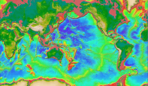
Data:Global Topography
From CSDMS
Global Topography dataset information page
Short Description
 |
| Bathymetry and topography of the world |
Statement: Global estimated bathymetric and integrated bathy-topo relief models; 1 minute (~2 km) and 30 arc-second (~1 km) cell sizes
Abstract: Global ocean bathymetry estimated from sea-surface satellite altimetry (Geosat and ERS-1) measurements and constrained by ship depth measurements.
Data format
| Data type: | Topography |
| Data origin: | Modeled |
| Data format: | GeoTIFF, ASCII |
| Other format: | GMT/Postscript |
| Data resolution: | 1 arc-minute (~2 km) and 30 arc-second (~1 km) cell sizes (horizontal) |
| Datum: | WGS 84 geographic (horizontal); sea level (vertical) |
Data Coverage
Spatial data coverage: Global (72N to 72S)
Temporal data coverage: Time averaged
Time period covered:
Availability
Download data: http://topex.ucsd.edu/WWW html/mar topo.html
Data source: http://topex.ucsd.edu/WWW html/mar topo.html
References
- Smith, W. H. F., and D. T. Sandwell, Global seafloor topography from satellite altimetry and ship depth soundings, Science, v. 277, p. 1957-1962, 26 Sept., 1997.
