Hydrography data descriptions
This is an automatically generated table.
Want to add your dataset to this list? Please complete this data form first. Feel free to contact us CSDMSweb@colorado.edu or use the wiki and follow one of the dataset links if you want to update the information about a dataset that is already listed.
There are 8 datasets described below.
| Dataset info | Type | Origin | Description | Data example |
|---|---|---|---|---|
| DDM30 | Hydrography | Modeled | Global drainage direction map | |
| HYDRO1k | Hydrography | Modeled | HYDRO1k is a geographic database providing comprehensive and consistent global coverage of optographically derived data sets. | 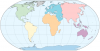 |
| HydroLAKES | Hydrography | Measured | HydroLAKES is a database aiming to provide the shoreline polygons of all global lakes with a surface area of at least 10 ha. | 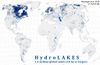 |
| HydroSHEDS | Hydrography | Modeled | Hydrological data and maps based on SHuttle Elevation Derivatives at multiple Scales. | |
| NHD | Hydrography | Measured | The National Hydrography Dataset | 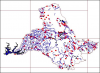 |
| North America 3 arcsec drainage area | Hydrography | Modeled | The drainage area of North America at 3 arc sec resolution, from 7°N, 55°W to 60°N, 142°W | 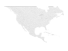 |
| North American River Width Data Set (NARWidth) | Hydrography | Measured | NARWidth is composed of planform morphometric measurements of North American rivers at approximately mean discharge | 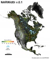 |
| SWBD | Hydrography | Measured | Shuttle Radar Topography Mission Water Body Dataset |  |
