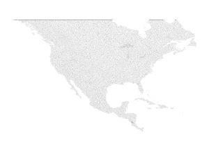
Data:North America 3 arcsec drainage area
North America 3 arcsec drainage area dataset information page
Short Description
 |
| log10(drainage area) |
Statement: The drainage area of North America at 3 arc sec resolution, from 7°N, 55°W to 60°N, 142°W
Abstract: [[Extended data description::The drainage area in m2 (rather than number of cells) for the 63600 x 104400 cells between 7°N, 55°W and 60°N, 142°W at 3 arcsecond resolution.
The 3 arcsecond flow direction data from HydroSHEDS were used as input to a drainage area calculation method (IDA). The drainage area data were created in 64-bit floating point ('double precision') format, but to reduce download size this was reduced to 32-bit floating point ('single precision') format for distribution. NetCDF4's level 1 deflation with shuffling was employed to further reduce file size.
The NetCDF file contains three variables: drainage_area, lon, and lat. The first of these contains the drainage area data, while the latter two contain the coordinates in degrees.
This product (North America 3 arcsecond drainage area) incorporates data from the HydroSHEDS database which is © World Wildlife Fund, Inc. (2006-2013) and has been used herein under license. WWF has not evaluated the data as altered and incorporated within (North America 3 arcsecond drainage area), and therefore gives no warranty regarding its accuracy, completeness, currency or suitability for any particular purpose. Portions of the HydroSHEDS database incorporate data which are the intellectual property rights of © USGS (2006-2008), NASA (2000-2005), ESRI (1992-1998), CIAT (2004-2006), UNEP-WCMC (1993), WWF (2004), Commonwealth of Australia (2007), and Her Royal Majesty and the British Crown and are used under license. The HydroSHEDS database and more information are available at http://www.hydrosheds.org.]]
Data format
| Data type: | Hydrography |
| Data origin: | Modeled |
| Data format: | NetCDF |
| Other format: | |
| Data resolution: | 3 arcsecond |
| Datum: |
Data Coverage
Spatial data coverage: 7°N, 55°W to 60°N, 142°W
Temporal data coverage: Time snap shot
Time period covered:
Availability
Download data: https://csdms.colorado.edu/pub/data/North America 3 arcsec drainage area/na da 3arcsec.nc
Data source: http://www.hydrosheds.org
References
- Richardson, A., C. N. Hill, and J. T. Perron (2014), IDA: An implicit, parallelizable method for calculating drainage area, Water Resour. Res., 50, 4110–4130, doi:10.1002/2013WR014326.
- Lehner, B., Verdin, K., Jarvis, A. (2008): New global hydrography derived from spaceborne elevation data. Eos, Transactions, AGU, 89(10): 93-94.
