Data:HydroSHEDS
HydroSHEDS dataset information page
Short Description
 |
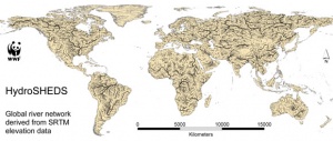
| Global river network |
Statement: Hydrological data and maps based on SHuttle Elevation Derivatives at multiple Scales.
Abstract: HydroSHEDS is a mapping product that provides hydrographic information for regional and global-scale applications in a consistent format. It offers a suite of geo-referenced data sets (vector and raster) at various scales, including river networks, watershed boundaries, drainage directions, and flow accumulations. HydroSHEDS is based on high-resolution elevation data obtained during a Space Shuttle flight for NASA's Shuttle Radar Topography Mission (SRTM).
The goal of developing HydroSHEDS was to generate key data layers to support regional and global watershed analyses, hydrological modeling, and freshwater conservation planning at a quality, resolution and extent that had previously been unachievable. Available resolutions range from 3 arc-second (approx. 90 meters at the equator) to 5 minute (approx. 10 km at the equator) with seamless near-global extent.
Data format
| Data type: | Hydrography |
| Data origin: | Modeled |
| Data format: | BIL, Shapefile |
| Other format: | |
| Data resolution: | 3 Arc-second, 15 Arc-second, 30 Arc-second and 5minute |
| Datum: |
Data Coverage
Spatial data coverage: Global
Temporal data coverage: Time snap shot
Time period covered: 2002
Availability
Download data: http://hydrosheds.cr.usgs.gov/dataavail.php
Data source: http://hydrosheds.cr.usgs.gov/index.php
References
- Lehner, B., Verdin, K., Jarvis, A. (2008): New global hydrography derived from spaceborne elevation data. Eos, Transactions, AGU, 89(10): 93-94.
