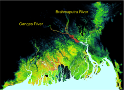
The Ganges-Brahmaputra Delta is one of the largest deltas in the world. In Bangladesh alone, 160 million people live in the floodplains. The Ganges and Brahmaputra Rivers and their delta are strongly impacted by the Asian summer monsoon. Widespread hazards relate to the intense seasonal rainfall: flooding, river erosion and channel switches. The people of Bangladesh have adapted to this dynamic delta system by raising villages above the annual flood level and embanking agricultural land.
Still, the lowlands of the Ganges-Brahmaputra Delta are considered one of the regions most at risk from climate change, and particularly from sea level rise. About 75 million people live in the GB coastal zone (defined as the region <10 m.a.s.l). It is thought that the impact of relative sea-level change will be profound in Bangladesh where 32% of the country is already affected by tides, salinization, and cyclones/storm surges. At the same time, the Ganges-Brahmaputra river system drains tremendous amounts of sediment (sand, silt and clay) from its steep Himalayan hinterland. We ask: how does this amount of sediment change with a changing monsoonal climate? Does this sediment aggrade fast enough to help counteract rapid sea-level rise?
Classroom organization This lab replicates and improves upon simulations originally run by Frances Dunn and Stephen Darby, reported in Darby et al. 2015. This simulation is driven by climate predictions (daily temperature and precipitation) obtained from the Hadley Centre (HadRM3P) Regional Climate Model. The Q0 realization is utilized in this lab.
This lab can be run on the CSDMS JupyterHub. (If you don't already have an account, follow the instructions to sign up at: https://csdms.colorado.edu/wiki/JupyterHub.) Run the lab Notebook by clicking the "start" link under the Run online heading at the top of this page. If you're an educator using this lab in a class, you can get CSDMS JupyterHub accounts for students. For more information, please contact us through the CSDMS Help Desk: https://github.com/csdms/help-desk.
Learning objectives Skills
Use pymt to run the HydroTrend model
Become familiar with a basic configuration of the HydroTrend model`
Make small changes to key input parameters in HydroTrend
Gain hands-on experience with visualizing output in Python
Key concepts
Simulation of discharge for the Ganges River
Simulation of suspended sediment discharge for the Ganges River
Explore mean annual water discharge trends through time
Lab notes
Launch binder
Instead of downloading the lab Notebook and running it locally, or running it through the CSDMS JupyterHub, you can also run it on Binder. Follow these steps:
Acknowledgements This material is based upon work supported by the National Science Foundation under Grant No. 1831623, Community Facility Support: The Community Surface Dynamics Modeling System (CSDMS).
References
Kettner, A.J., and Syvitski, J.P.M., 2008. HydroTrend version 3.0: a Climate-Driven Hydrological Transport Model that Simulates Discharge and Sediment Load leaving a River System. Computers & Geosciences, 34(10), 1170-1183. doi: 10.1016/j.cageo.2008.02.008
Darby, S. E., Dunn, F. E., Nicholls, R.J., Rahman, M. and Riddy, L. 2015. A first look at the influence of anthropogenic climate change on the future delivery of fluvial sediment to the Ganges–Brahmaputra–Meghna delta. Environmental Science: Processes & Impacts. doi:10.1039/c5em00252d