GeoTiff Data Component
Contributor(s)
Mark Piper at University of Colorado Boulder.
Introduction

TODO
Classroom organization
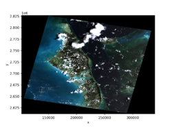
This lab includes examples of using the GeoTiff data component in a Jupyter Notebook, in a shell script, and in a Python program. Try editing these examples to download, open, and display data from other GeoTIFF files.
Learning objectives
Skills
Skills
- Use an application programming interface (API) for a Python library
- Use a Basic Model Interface (BMI)
Key concepts
- Access data through a data component
- Understand the difference between an API and a BMI, as well as their relative strengths
Lab notes
This lab can be run on the CSDMS JupyterHub. (If you don't already have an account, follow the instructions to sign up at: https://csdms.colorado.edu/wiki/JupyterHub.) Run the lab notebooks by clicking the "start" link under the Run online heading at the top of this page. If you're an educator using this lab in a class, you can get CSDMS JupyterHub accounts for students. For more information, please contact us through the CSDMS Help Desk: https://github.com/csdms/help-desk.
Requirements
If run locally, see installation instructions in the bmi-geotiff repository: https://github.com/csdms/bmi-geotiff.
Acknowledgements
This work is supported by the National Science Foundation under Award No. 1831623, Community Facility Support: The Community Surface Dynamics Modeling System (CSDMS).
References
- Piper, M. (2021). CSDMS GeoTIFF data component (Version 0.2.3) (Computer software). https://doi.org/10.5281/zenodo.4721475
