Lab-0029: Difference between revisions
No edit summary |
No edit summary |
||
| Line 2: | Line 2: | ||
|Labtitle=GeoTiff Data Component | |Labtitle=GeoTiff Data Component | ||
|LabCOModule=1 of 1 | |LabCOModule=1 of 1 | ||
|LabDateContributedOrUpdated= | |LabDateContributedOrUpdated=2022-04-19 | ||
|LabDescriptionShort=Learn how to access data and metadata from a GeoTIFF file through an API or a BMI with the CSDMS GeoTiff data component. | |LabDescriptionShort=Learn how to access data and metadata from a GeoTIFF file through an API or a BMI with the CSDMS GeoTiff data component. | ||
|LabCODuration=1.0 hrs | |LabCODuration=1.0 hrs | ||
| Line 8: | Line 8: | ||
|LabAssociatedLesson=Jupyter Notebook | |LabAssociatedLesson=Jupyter Notebook | ||
|LabURLDownloadNotebook=https://github.com/csdms/bmi-geotiff/tree/main/examples | |LabURLDownloadNotebook=https://github.com/csdms/bmi-geotiff/tree/main/examples | ||
|LabURLStartNotebook=https:// | |LabURLStartNotebook=https://jupyter.openearthscape.org/hub/user-redirect/git-pull?repo=https%3A%2F%2Fgithub.com%2Fcsdms%2Fbmi-geotiff&urlpath=tree%2Fbmi-geotiff%2Fexamples&branch=main | ||
|LabURL2StartNotebook=https://lab.openearthscape.org/hub/user-redirect/git-pull?repo=https%3A%2F%2Fgithub.com%2Fcsdms%2Fbmi-geotiff&urlpath=tree%2Fbmi-geotiff%2Fexamples&branch=main | |||
}} | }} | ||
{{LabContributorData | {{LabContributorData | ||
| Line 16: | Line 17: | ||
}} | }} | ||
{{LabIntro | {{LabIntro | ||
|LabDescription=GeoTiff is a Python library for accessing data and metadata from a GeoTIFF file through an API or a BMI. | |LabDescription=<p>GeoTiff is a Python library for accessing data and metadata from a GeoTIFF file through an API or a BMI.</p> | ||
The bmi-geotiff library accepts a filepath or an URL to a GeoTIFF file. Data are loaded into an xarray DataArray using the experimental open_rasterio method. The API is wrapped with a Basic Model Interface (BMI), which provides a standard set of functions for coupling with data or models that also expose a BMI. | <p>The bmi-geotiff library accepts a filepath or an URL to a GeoTIFF file. Data are loaded into an xarray DataArray using the experimental open_rasterio method. The API is wrapped with a Basic Model Interface (BMI), which provides a standard set of functions for coupling with data or models that also expose a BMI.</p> | ||
More information on GeoTiff can found in its documentation: https://bmi-geotiff.readthedocs.io. | <p>More information on GeoTiff can found in its documentation: https://bmi-geotiff.readthedocs.io.</p> | ||
|LabPicture=Example-rgb.png | |LabPicture=Example-rgb.png | ||
}} | }} | ||
| Line 40: | Line 41: | ||
}} | }} | ||
{{LabNotes | {{LabNotes | ||
|LabNotesInstructions=This lab can be run on the CSDMS | |LabNotesInstructions=<p>This lab can be run on the <em>lab</em> (for educators) and <em>jupyter</em> (for general use) instances of the OpenEarthscape JupyterHub: just click one of the links under the <strong>Run online using</strong> heading at the top of this page, then run the notebook in the "CSDMS" kernel.</p> | ||
<p>If you don't already have a JupyterHub account, follow the instructions to sign up at https://csdms.colorado.edu/wiki/JupyterHub. If you're an educator, you can get JupyterHub accounts for students--please contact us through the CSDMS Help Desk: https://csdms.github.io/help-desk.</p> | |||
|LabNotesRequirements=If run locally, see installation instructions in the bmi-geotiff repository: https://github.com/csdms/bmi-geotiff. | |LabNotesRequirements=If run locally, see installation instructions in the bmi-geotiff repository: https://github.com/csdms/bmi-geotiff. | ||
|LabAcknowledgements=This work is supported by the National Science Foundation under Award No. 1831623, Community Facility Support: The Community Surface Dynamics Modeling System (CSDMS). | |LabAcknowledgements=This work is supported by the National Science Foundation under Award No. 1831623, Community Facility Support: The Community Surface Dynamics Modeling System (CSDMS). | ||
Revision as of 16:44, 19 April 2022
GeoTiff Data Component
Contributor(s)

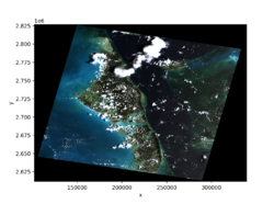
GeoTiff is a Python library for accessing data and metadata from a GeoTIFF file through an API or a BMI.
The bmi-geotiff library accepts a filepath or an URL to a GeoTIFF file. Data are loaded into an xarray DataArray using the experimental open_rasterio method. The API is wrapped with a Basic Model Interface (BMI), which provides a standard set of functions for coupling with data or models that also expose a BMI.
More information on GeoTiff can found in its documentation: https://bmi-geotiff.readthedocs.io.
Classroom organization
This lab includes examples of using the GeoTiff data component in a Jupyter Notebook, in a shell script, and in a Python program. Try editing these examples to download, open, and display data from other GeoTIFF files.
Skills
- Use an application programming interface (API) for a Python library
- Use a Basic Model Interface (BMI)
- Access data through a data component
- Understand the difference between an API and a BMI, as well as their relative strengths
Lab notes
This lab can be run on the lab (for educators) and jupyter (for general use) instances of the OpenEarthscape JupyterHub: just click one of the links under the Run online using heading at the top of this page, then run the notebook in the "CSDMS" kernel.
If you don't already have a JupyterHub account, follow the instructions to sign up at https://csdms.colorado.edu/wiki/JupyterHub. If you're an educator, you can get JupyterHub accounts for students--please contact us through the CSDMS Help Desk: https://csdms.github.io/help-desk.
Requirements
If run locally, see installation instructions in the bmi-geotiff repository: https://github.com/csdms/bmi-geotiff.
Acknowledgements
This work is supported by the National Science Foundation under Award No. 1831623, Community Facility Support: The Community Surface Dynamics Modeling System (CSDMS).
References
- Piper, M. (2021). CSDMS GeoTIFF data component (Version 0.2.3) (Computer software). https://doi.org/10.5281/zenodo.4721475
