Data:Global Multibeam Bathymetry
Global Multibeam Bathymetry dataset information page
Short Description
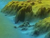
| Image of a multibeam survey |
Statement: NGDC's Global Multibeam Bathymetry
Abstract: NGDC is the US national archive for multibeam bathymetric data and presently holds over 15.7 million nautical miles of ship tracklines (1187 surveys) received from sources worldwide.
In addition to deepwater data, the multibeam database also includes hydrographic multibeam survey data from the NOS. Associated NOS data products, including 3D images and grids, are available via the NOS Hydrographic Survey Data Map Service.
The interactive map for these data displays the geographic locations of multibeam bathymetric data by institutional source or by instrument. Data NOT at NGDC but in the GEODAS inventory can be viewed by searching the inventory for multibeam bathymetric data not at NGDC.
Data format
| Data type: | Topography |
| Data origin: | Measured |
| Data format: | |
| Other format: | |
| Data resolution: | |
| Datum: |
Data Coverage
Spatial data coverage: Global
Temporal data coverage: Time snap shot
Time period covered:
Availability
Download data: http://www.ngdc.noaa.gov/mgg/bathymetry/multibeam.html
Data source: http://www.ngdc.noaa.gov/mgg/bathymetry/multibeam.html

