2022 CSDMS meeting-074: Difference between revisions
From CSDMS
(Created page with "{{CSDMS meeting personal information template-2022 |CSDMS meeting first name=Julianne |CSDMS meeting last name=Davis |CSDMS meeting institute=UNC Chapel Hill EMES |CSDMS meeti...") |
No edit summary |
||
| (4 intermediate revisions by 2 users not shown) | |||
| Line 2: | Line 2: | ||
|CSDMS meeting first name=Julianne | |CSDMS meeting first name=Julianne | ||
|CSDMS meeting last name=Davis | |CSDMS meeting last name=Davis | ||
|CSDMS meeting institute= | |CSDMS meeting institute=University of North Carolina at Chapel Hill | ||
|CSDMS meeting city=Chapel Hill | |CSDMS meeting city=Chapel Hill | ||
|CSDMS meeting country=United States | |CSDMS meeting country=United States | ||
| Line 22: | Line 22: | ||
}} | }} | ||
{{CSDMS meeting abstract title temp2022 | {{CSDMS meeting abstract title temp2022 | ||
|CSDMS meeting abstract title= | |CSDMS meeting abstract title=Delta progradation and lake infilling in the Peace-Athabasca Delta, Canada | ||
|Working_group_member_WG_FRG=Terrestrial Working Group, Hydrology Focus Research Group | |Working_group_member_WG_FRG=Terrestrial Working Group, Hydrology Focus Research Group | ||
}} | }} | ||
{{CSDMS meeting abstract template 2022 | {{CSDMS meeting abstract template 2022 | ||
|CSDMS meeting abstract= | |CSDMS meeting abstract=The Peace-Athabasca Delta (PAD) in Alberta, Canada, is one of the largest inland deltas in the world. The hundreds of shallow lakes and distributary channel networks contribute to the incredible biodiversity in this region and also form the primary transportation routes for summer boat travel and ice roads in winter. Over the last few decades, however, there has been rising concern over declining lake levels. While the complex and changing hydrology is the focus of many studies, little is known about how changing geomorphology will impact lake water storage. | ||
In this work, I will focus on one shallow PAD lake, Mamawi Lake, which is located near the center of the PAD and forms a key hydrologic connection. A subdelta has been forming in Mamawi Lake since 1982 and, as it continues to grow, may compromise hydrologic connectivity and navigability. To investigate past and future subdelta progradation, I will use Delft3D-FLOW as well as field measurements and satellite remote sensing. To develop a model that acceptably mimics subdelta growth, I will compare observed progradation rates and delta form, as determined from the optical satellite record, with predicted delta growth and planform from Delft3D simulations. By iteratively comparing observed and predicted subdelta characteristics, I can optimize model inputs to create a model that best resembles the historical growth of the Mamawi Lake subdelta. Then, with this optimized model, I will run longer simulations (on the order of 100 years) to estimate potential timelines of lake infilling and loss of navigability. | |||
|CSDMS meeting posterPDF=Davis_CSDMS_Poster_Final.pdf | |||
|CSDMS meeting posterPNG=Davis_CSDMS_Poster_Final.png | |||
}} | }} | ||
{{blank line template}} | {{blank line template}} | ||
Latest revision as of 14:18, 31 May 2022
(if you haven't already)
Log in (or create account for non-CSDMS members)
Forgot username? Search or email:CSDMSweb@colorado.edu
Browse abstracts
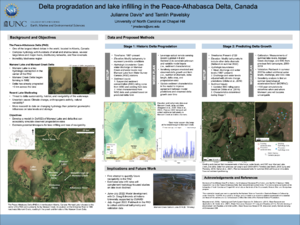
Delta progradation and lake infilling in the Peace-Athabasca Delta, Canada
Julianne Davis,
University of North Carolina at Chapel Hill Chapel Hill North Carolina, United States. jmsdavis@unc.edu
The Peace-Athabasca Delta (PAD) in Alberta, Canada, is one of the largest inland deltas in the world. The hundreds of shallow lakes and distributary channel networks contribute to the incredible biodiversity in this region and also form the primary transportation routes for summer boat travel and ice roads in winter. Over the last few decades, however, there has been rising concern over declining lake levels. While the complex and changing hydrology is the focus of many studies, little is known about how changing geomorphology will impact lake water storage.
In this work, I will focus on one shallow PAD lake, Mamawi Lake, which is located near the center of the PAD and forms a key hydrologic connection. A subdelta has been forming in Mamawi Lake since 1982 and, as it continues to grow, may compromise hydrologic connectivity and navigability. To investigate past and future subdelta progradation, I will use Delft3D-FLOW as well as field measurements and satellite remote sensing. To develop a model that acceptably mimics subdelta growth, I will compare observed progradation rates and delta form, as determined from the optical satellite record, with predicted delta growth and planform from Delft3D simulations. By iteratively comparing observed and predicted subdelta characteristics, I can optimize model inputs to create a model that best resembles the historical growth of the Mamawi Lake subdelta. Then, with this optimized model, I will run longer simulations (on the order of 100 years) to estimate potential timelines of lake infilling and loss of navigability.