2022 CSDMS meeting-070: Difference between revisions
From CSDMS
No edit summary |
No edit summary |
||
| (6 intermediate revisions by 2 users not shown) | |||
| Line 3: | Line 3: | ||
|CSDMS meeting last name=Daud Masungulwa | |CSDMS meeting last name=Daud Masungulwa | ||
|CSDMS Pronouns=he/him | |CSDMS Pronouns=he/him | ||
|CSDMS meeting institute=Virginia Tech | |CSDMS meeting institute=Virginia Tech, | ||
|CSDMS meeting city=Blacksburg | |CSDMS meeting city=Blacksburg, | ||
|CSDMS meeting country=United States | |CSDMS meeting country=United States | ||
|CSDMS meeting state=Virginia | |CSDMS meeting state=Virginia | ||
| Line 11: | Line 11: | ||
}} | }} | ||
{{CSDMS meeting select clinics1 2022 | {{CSDMS meeting select clinics1 2022 | ||
|CSDMS_meeting_select_clinics1_2022= | |CSDMS_meeting_select_clinics1_2022=3) The Art of Modeling | ||
}} | }} | ||
{{CSDMS meeting select clinics2 2022 | {{CSDMS meeting select clinics2 2022 | ||
|CSDMS_meeting_select_clinics2_2022= | |CSDMS_meeting_select_clinics2_2022=3) Introduction to Landlab | ||
}} | }} | ||
{{CSDMS meeting select clinics3 2022 | {{CSDMS meeting select clinics3 2022 | ||
| Line 24: | Line 24: | ||
{{CSDMS meeting abstract title temp2022 | {{CSDMS meeting abstract title temp2022 | ||
|CSDMS meeting abstract title=Elucidating the Magma Plumbing System of the Active Volcano Ol Doinyo Lengai, Natron Rift, Tanzania Using Geodesy and Numerical Modeling | |CSDMS meeting abstract title=Elucidating the Magma Plumbing System of the Active Volcano Ol Doinyo Lengai, Natron Rift, Tanzania Using Geodesy and Numerical Modeling | ||
|Working_group_member_WG_FRG=Terrestrial Working Group, Geodynamics Focus Research Group | |Working_group_member_WG_FRG=Terrestrial Working Group, Human Dimensions Focus Research Group, Geodynamics Focus Research Group | ||
}} | }} | ||
{{CSDMS meeting authors template | {{CSDMS meeting authors template | ||
|CSDMS meeting coauthor first name abstract=D. Sarah | |CSDMS meeting coauthor first name abstract=D. Sarah | ||
|CSDMS meeting coauthor last name abstract=Stamps | |CSDMS meeting coauthor last name abstract=Stamps | ||
|CSDMS meeting coauthor institute / Organization=Virginia Tech | |CSDMS meeting coauthor institute / Organization=Virginia Tech, | ||
|CSDMS meeting coauthor town-city=Blacksburg | |CSDMS meeting coauthor town-city=Blacksburg, | ||
|CSDMS meeting coauthor country=United States | |CSDMS meeting coauthor country=United States | ||
|State=Virginia | |State=Virginia | ||
| Line 46: | Line 46: | ||
|CSDMS meeting coauthor first name abstract=Mong-Han | |CSDMS meeting coauthor first name abstract=Mong-Han | ||
|CSDMS meeting coauthor last name abstract=Huang | |CSDMS meeting coauthor last name abstract=Huang | ||
|CSDMS meeting coauthor institute / Organization=University of Maryland, | |CSDMS meeting coauthor institute / Organization=University of Maryland, | ||
|CSDMS meeting coauthor town-city= | |CSDMS meeting coauthor town-city=College Park, | ||
|CSDMS meeting coauthor country=United States | |CSDMS meeting coauthor country=United States | ||
|State=Maryland | |State=Maryland | ||
| Line 55: | Line 55: | ||
|CSDMS meeting coauthor first name abstract=Elifuraha | |CSDMS meeting coauthor first name abstract=Elifuraha | ||
|CSDMS meeting coauthor last name abstract=Saria | |CSDMS meeting coauthor last name abstract=Saria | ||
|CSDMS meeting coauthor institute / Organization=Ardhi University | |CSDMS meeting coauthor institute / Organization=Ardhi University, | ||
|CSDMS meeting coauthor town-city=Dar es Salaam | |CSDMS meeting coauthor town-city=Dar es Salaam, | ||
|CSDMS meeting coauthor country=Tanzania | |CSDMS meeting coauthor country=Tanzania | ||
|CSDMS meeting coauthor email address=saria.elifuraha@gmail.com | |CSDMS meeting coauthor email address=saria.elifuraha@gmail.com | ||
| Line 63: | Line 63: | ||
|CSDMS meeting coauthor first name abstract=Kang-Hyeun | |CSDMS meeting coauthor first name abstract=Kang-Hyeun | ||
|CSDMS meeting coauthor last name abstract=Ji | |CSDMS meeting coauthor last name abstract=Ji | ||
|CSDMS meeting coauthor institute / Organization=KIGAM | |CSDMS meeting coauthor institute / Organization=KIGAM, | ||
|CSDMS meeting coauthor town-city=Daejeon | |CSDMS meeting coauthor town-city=Daejeon, | ||
|CSDMS meeting coauthor country=Korea, South | |CSDMS meeting coauthor country=Korea, South | ||
|CSDMS meeting coauthor email address=khji@kigam.re.kr | |CSDMS meeting coauthor email address=khji@kigam.re.kr | ||
| Line 71: | Line 71: | ||
|CSDMS meeting coauthor first name abstract=Kelsey | |CSDMS meeting coauthor first name abstract=Kelsey | ||
|CSDMS meeting coauthor last name abstract=Popolizio | |CSDMS meeting coauthor last name abstract=Popolizio | ||
|CSDMS meeting coauthor institute / Organization=Virginia Tech | |CSDMS meeting coauthor institute / Organization=Virginia Tech, | ||
|CSDMS meeting coauthor town-city=Blacksburg | |CSDMS meeting coauthor town-city=Blacksburg, | ||
|CSDMS meeting coauthor country=United States | |CSDMS meeting coauthor country=United States | ||
|State=Virginia | |State=Virginia | ||
| Line 79: | Line 79: | ||
{{CSDMS meeting abstract template 2022 | {{CSDMS meeting abstract template 2022 | ||
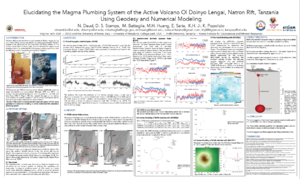
|CSDMS meeting abstract=The active volcano Ol Doinyo Lengai is located in the magma-rich southern Eastern Branch of the East African Rift and erupts unique low-temperature carbonatites. Between 2007 and 2010, the volcano had several explosions and erupted with ash falls, and lava flows (VEI 3) that caused damage to the nearby communities. Although this volcano has been studied for decades, its plumbing system is still poorly understood, in part, because of the lack of precise observations of surface deformation during periods of quiet and unrest. This study investigates the volcanic plumbing system of Ol Doinyo Lengai and surroundings using data from the permanent Global Navigation Satellite System (GNSS) network monitoring the volcano called TZVOLCANO and Interferometric Synthetic Aperture Radar (InSAR) observations. We calculate velocities for 6 continuously operating GNSS sites distributed around Ol Doinyo Lengai for a timespan between 2016 and 2021 and also process InSAR data for nearly the same time-period to constrain surface motions. We then use the GNSS deformation signals and InSAR observations to solve for magma sources embedded in a homogeneous and elastic half space using the USGS inversion code dMODELS. Both GNSS and InSAR inversion results quantify a deflating spherical geometry source at a depth of ~1.3 km with a volume change ∆V of -0.05 ± 0.01x10⁶m3 located east of Ol Doinyo Lengai and southwest of the dormant volcano Gelai. InSAR inversions alone also suggest a closing dike model at a depth of ~9 km similar to the location resolved for the 2007 Ol Doinyo Lengai dike. This work suggests a shallow magma reservoir exists east of Ol Doinyo Lengai and that the 2007 dike is actively contracting. This magma source influences the onset, size, duration and hazard of eruptions of the volcano, and plays a significant role in triggering slip on border faults during early phases of continental rifting through stress transfer. | |CSDMS meeting abstract=The active volcano Ol Doinyo Lengai is located in the magma-rich southern Eastern Branch of the East African Rift and erupts unique low-temperature carbonatites. Between 2007 and 2010, the volcano had several explosions and erupted with ash falls, and lava flows (VEI 3) that caused damage to the nearby communities. Although this volcano has been studied for decades, its plumbing system is still poorly understood, in part, because of the lack of precise observations of surface deformation during periods of quiet and unrest. This study investigates the volcanic plumbing system of Ol Doinyo Lengai and surroundings using data from the permanent Global Navigation Satellite System (GNSS) network monitoring the volcano called TZVOLCANO and Interferometric Synthetic Aperture Radar (InSAR) observations. We calculate velocities for 6 continuously operating GNSS sites distributed around Ol Doinyo Lengai for a timespan between 2016 and 2021 and also process InSAR data for nearly the same time-period to constrain surface motions. We then use the GNSS deformation signals and InSAR observations to solve for magma sources embedded in a homogeneous and elastic half space using the USGS inversion code dMODELS. Both GNSS and InSAR inversion results quantify a deflating spherical geometry source at a depth of ~1.3 km with a volume change ∆V of -0.05 ± 0.01x10⁶m3 located east of Ol Doinyo Lengai and southwest of the dormant volcano Gelai. InSAR inversions alone also suggest a closing dike model at a depth of ~9 km similar to the location resolved for the 2007 Ol Doinyo Lengai dike. This work suggests a shallow magma reservoir exists east of Ol Doinyo Lengai and that the 2007 dike is actively contracting. This magma source influences the onset, size, duration and hazard of eruptions of the volcano, and plays a significant role in triggering slip on border faults during early phases of continental rifting through stress transfer. | ||
|CSDMS meeting posterPDF=Daud_poster_60x36in_CSDMS_Workshop.pdf | |||
|CSDMS meeting posterPNG=Daud_poster_60x36in_CSDMS_Workshop.png | |||
}} | }} | ||
{{blank line template}} | {{blank line template}} | ||
Latest revision as of 21:27, 9 March 2022
(if you haven't already)
Log in (or create account for non-CSDMS members)
Forgot username? Search or email:CSDMSweb@colorado.edu
Browse abstracts
Elucidating the Magma Plumbing System of the Active Volcano Ol Doinyo Lengai, Natron Rift, Tanzania Using Geodesy and Numerical Modeling
Ntambila Simon Daud Masungulwa,
(he/him),Virginia Tech, Blacksburg, Virginia, United States. dntambila@vt.edu
D. Sarah Stamps, Virginia Tech, Blacksburg, Virginia, United States. dstamps@vt.edu
Maurizio Battaglia, The University of Rome, Italy Rome , Italy. maurizio.battaglia@uniroma1.it
Mong-Han Huang, University of Maryland, College Park, Maryland, United States. mhhuang@umd.edu
Elifuraha Saria, Ardhi University, Dar es Salaam, , Tanzania. saria.elifuraha@gmail.com
Kang-Hyeun Ji, KIGAM, Daejeon, , Korea, South. khji@kigam.re.kr
Kelsey Popolizio, Virginia Tech, Blacksburg, Virginia, United States. kelspop@vt.edu
The active volcano Ol Doinyo Lengai is located in the magma-rich southern Eastern Branch of the East African Rift and erupts unique low-temperature carbonatites. Between 2007 and 2010, the volcano had several explosions and erupted with ash falls, and lava flows (VEI 3) that caused damage to the nearby communities. Although this volcano has been studied for decades, its plumbing system is still poorly understood, in part, because of the lack of precise observations of surface deformation during periods of quiet and unrest. This study investigates the volcanic plumbing system of Ol Doinyo Lengai and surroundings using data from the permanent Global Navigation Satellite System (GNSS) network monitoring the volcano called TZVOLCANO and Interferometric Synthetic Aperture Radar (InSAR) observations. We calculate velocities for 6 continuously operating GNSS sites distributed around Ol Doinyo Lengai for a timespan between 2016 and 2021 and also process InSAR data for nearly the same time-period to constrain surface motions. We then use the GNSS deformation signals and InSAR observations to solve for magma sources embedded in a homogeneous and elastic half space using the USGS inversion code dMODELS. Both GNSS and InSAR inversion results quantify a deflating spherical geometry source at a depth of ~1.3 km with a volume change ∆V of -0.05 ± 0.01x10⁶m3 located east of Ol Doinyo Lengai and southwest of the dormant volcano Gelai. InSAR inversions alone also suggest a closing dike model at a depth of ~9 km similar to the location resolved for the 2007 Ol Doinyo Lengai dike. This work suggests a shallow magma reservoir exists east of Ol Doinyo Lengai and that the 2007 dike is actively contracting. This magma source influences the onset, size, duration and hazard of eruptions of the volcano, and plays a significant role in triggering slip on border faults during early phases of continental rifting through stress transfer.