Land cover data
From CSDMS
Land cover data descriptions
This is an automatically generated table.
Want to add your dataset to this list? Please complete this data form first. Feel free to contact us CSDMSweb@colorado.edu or use the wiki and follow one of the dataset links if you want to update the information about a dataset that is already listed.
There are 10The part "]]" of the query was not understood.</br>Results might not be as expected. datasets described below.
The part "]]" of the query was not understood.</br>Results might not be as expected.| Dataset info | Type | Origin | Description | Data example |
|---|---|---|---|---|
| 3D Land Mapping | Land Cover | Measured | Combining Lidar and Radar for Remote Sensing of Land Surfaces | 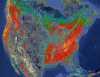 |
| GIMMS | Land Cover | Measured | Global Inventory Modeling and Mapping Studies (GIMMS) | 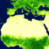 |
| GLC-SHARE | Land Cover | Measured | Global Land Cover-SHARE (GLC-SHARE) provides access to an assembled product of global land cover. | 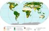 |
| Geomorpho90m | Land Cover | Measured | A global dataset comprising of different geomorphometric features derived from the MERIT-Digital Elevation Model (DEM) - the best global, high-resolution DEM available. | |
| GlobCover | Land Cover | Measured | Global Land Cover Map | |
| Global Cropland Area (1960-2100) | Land Cover | Modeled | Global Cropland Area predictions by the GLUDM model |  |
| Global Forest Heights | Land Cover | Measured | Forest canopy height globally with spaceborne lidar | 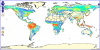 |
| LUSoils v.1 | Land Cover | Modeled | Linking global land use and land cover to hydrologic soil groups from 850 to 2015. | 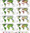 |
| NLCD 1992 | Land Cover | Modeled | National Land Cover Dataset 1992 | 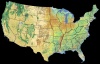 |
| NLCD 2001 | Land Cover | Modeled | National Land Cover Database of 2001 | 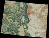 |
