Meeting:Abstract 2011 CSDMS meeting-007: Difference between revisions
No edit summary |
m Text replacement - "USA" to "United States" |
||
| (2 intermediate revisions by the same user not shown) | |||
| Line 19: | Line 19: | ||
|CSDMS meeting city=Tempe | |CSDMS meeting city=Tempe | ||
|CSDMS meeting state=Arizona | |CSDMS meeting state=Arizona | ||
|CSDMS meeting country= | |CSDMS meeting country=United States | ||
|CSDMS meeting email address=michael.barton@asu.edu | |CSDMS meeting email address=michael.barton@asu.edu | ||
|CSDMS meeting phone=480-965-6262 | |CSDMS meeting phone=480-965-6262 | ||
| Line 35: | Line 35: | ||
|CSDMS meeting coauthor town-city=Tempe | |CSDMS meeting coauthor town-city=Tempe | ||
|State=Arizona | |State=Arizona | ||
|CSDMS meeting coauthor country= | |CSDMS meeting coauthor country=United States | ||
|CSDMS meeting coauthor email address=isaac.ullah@asu.edu | |CSDMS meeting coauthor email address=isaac.ullah@asu.edu | ||
}} | }} | ||
| Line 44: | Line 44: | ||
|CSDMS meeting coauthor town-city=Raleigh | |CSDMS meeting coauthor town-city=Raleigh | ||
|State=North Carolina | |State=North Carolina | ||
|CSDMS meeting coauthor country= | |CSDMS meeting coauthor country=United States | ||
|CSDMS meeting coauthor email address=hmitaso@ncsu.edu | |CSDMS meeting coauthor email address=hmitaso@ncsu.edu | ||
}} | }} | ||
Latest revision as of 14:10, 10 June 2017
Browse abstracts
High resolution surface process modeling in a GRASS GIS environment
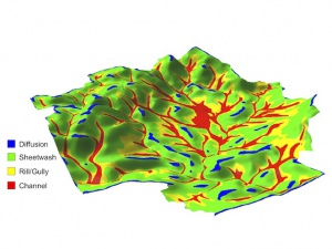
[[Image:|300px|right|link=File:]]As part of the Mediterranean Landscape Dynamics (MedLand) project to create a modeling laboratory for human-landscape interaction, we have developed a suite of landscape evolution tools in the GRASS GIS environment. The core of this tool set is a Python script to estimate sediment transport for hillslopes, gullies/rills, and small channels, and simulate resulting terrain change for high-resolution 3D digital landscapes. Because it takes advantage of raster-optimized routines in GRASS, it is very fast on normal desktop systems, making it ideal for simulating long-term landscape change resulting from human activity, climate change, or other drivers. We provide examples of how this landscape evolution model is being used in the MedLand project.

