Uploads by Bin Cao
From CSDMS
This special page shows all uploaded files.
| Date | Name | Thumbnail | Size | Description | Versions |
|---|---|---|---|---|---|
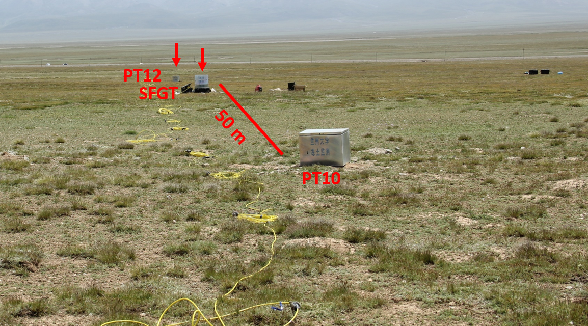
| 09:41, 30 March 2017 | Land Cover.png (file) (delete) |  |
1.93 MB | Fig. 2 Photograph of land cover taken in 31/07/2015. | 1 |
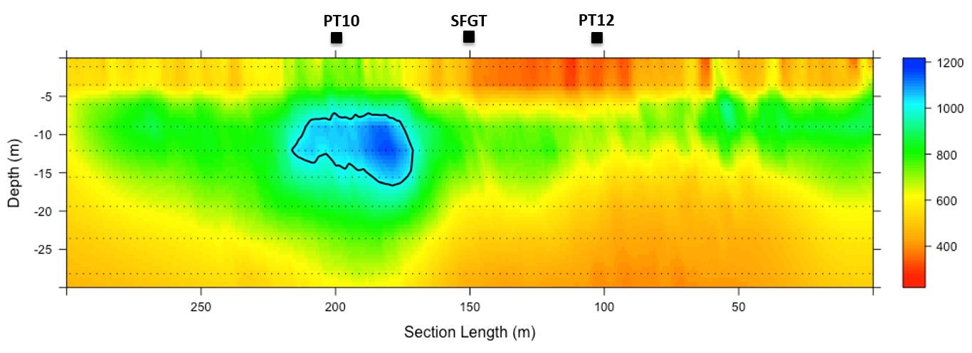
| 09:22, 30 March 2017 | ERT-based Permafrost Island.png (file) (delete) |  |
256 KB | Fig. 1 ERT measurements conducted in 31/07/2015 with an electrode probe interval of 5 m. Permafrost island are roughly determined by the resistivity contour of 1010 Ω, which is the resistivity value at the interface of frozen/unfrozen. Borehole locati... | 1 |
