Model:Sedflux

From CSDMS


Sedflux


Metadata

Also known as
Model type Modular
Model part of larger framework
Note on status model
Date note status model
Incorporated models or components:
Spatial dimensions 2D, 3D
Spatial extent
Model domain Coastal, Marine
One-line model description Basin filling stratigraphic model
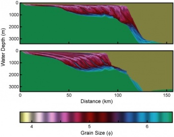
Extended model description Sedflux-2.0 is the newest version of the Sedflux basin-filling model. Sedflux-2.0 provides a framework within which individual process-response models of disparate time and space resolutions communicate with one another to deliver multi grain sized sediment load across a continental margin.
Keywords:

sediment transport, geodynamics, stratigraphy,

Name Eric Hutton
Type of contact Model developer
Institute / Organization CSDMS, INSTAAR, University of Colorado
Postal address 1 1560 30th street
Postal address 2
Town / City Boulder
Postal code 80305
State Colorado
Country United States
Email address huttone@colorado.edu
Phone
Fax


Supported platforms
Unix, Linux, Mac OS
Other platform
Programming language

C

Other program language
Code optimized
Multiple processors implemented
Nr of distributed processors
Nr of shared processors
Start year development 1997
Does model development still take place? Yes
If above answer is no, provide end year model development
Code development status Only maintenance
When did you indicate the 'code development status'? 2020
Model availability As code
Source code availability
(Or provide future intension)
Through web repository
Source web address https://github.com/mcflugen/sedflux
Source csdms web address
Program license type GPL v2
Program license type other
Memory requirements 2GB
Typical run time minutes to days


Describe input parameters River mouth characteristics (velocity, width, depth, concentration) averaged daily, or longer.

Initial bathymetry. Input sediment distribution and properties of each grain type. Optionally, any of: tectonics, sea level, wave climate, and currents

Input format ASCII
Other input format
Describe output parameters Sediment properties that include (but are not limited to) bulk density, grain size, porosity, and permeability. These are averaged over are user-specified vertical resolution (typically mm to cm).

Sea-floor properties that include slope, water depth, and sand fraction.

Output format Binary
Other output format
Pre-processing software needed? No
Describe pre-processing software
Post-processing software needed? No
Describe post-processing software
Visualization software needed? Yes
If above answer is yes Matlab
Other visualization software


Describe processes represented by the model surface plumes, hyperpycnal plumes, sediment slope failure that results in turbidity currents or debris flows, subsidence, compaction, sediment remobilization due to waves and currents, river avulsion
Describe key physical parameters and equations Too numerous to list.
Describe length scale and resolution constraints Vertically: mm to cm; Horizontally: 10s of m to 1000 of m
Describe time scale and resolution constraints Days or greater. Component processes can have much higher resolutions for numerical stability.
Describe any numerical limitations and issues --


Describe available calibration data sets
Upload calibration data sets if available:
Describe available test data sets
Upload test data sets if available:
Describe ideal data for testing


Do you have current or future plans for collaborating with other researchers? None
Is there a manual available? Yes
Upload manual if available:
Model website if any https://github.com/mcflugen/sedflux
Model forum / discussion board
Comments No


This part will be filled out by CSDMS staff

OpenMI compliant No but possible
BMI compliant Yes
WMT component Yes
PyMT component Yes
Is this a data component
DOI model 10.1594/IEDA/100161
For model version 2.1
Year version submitted 2011
Link to file https://csdms.colorado.edu/pub/models/doi-source-code/sedflux-10.1594.IEDA.100161-2.1.tar.gz
Can be coupled with:
Model info

Nr. of publications: 25
Total citations: 766
h-index: 14
m-quotient: 0.61
Qrcode Sedflux.png
Link to this page


sedflux-2.0

Subsidence.jpg

project_partner_badge.gif

Sedflux-2.0 is the newest version of the Sedflux basin-filling model. Sedflux-2.0 provides a framework within which individual process-response models of disparate time and space resolutions communicate with one another to deliver multi grain sized sediment load across a continental margin. Version 2.0 introduces a series of new process models, and the ability to operate in one of two modes to track the evolution of stratigraphy in either two or three dimensions. Additions to the 2D-mode include the addition of models that simulate

  1. erosion and deposition of sediment along a riverbed,
  2. cross-shore transport due to ocean waves, and
  3. turbidity currents and hyperpycnal flows.

New processes in the 3D-mode include

  1. river channel avulsion,
  2. two-dimensional diffusion due to ocean storms, and
  3. two-dimensional flexure due to sediment loading.

The spatial resolution of the architecture is typically 1-25 cm in the vertical, and 10-100 m in the horizontal when operating in 2D-mode. In 3D-mode, the ....


References


Nr. of publications: 25
Total citations: 766
h-index: 14
m-quotient: 0.61


Featured publication(s)YearModel describedType of ReferenceCitations
Overeem, I.; Syvitski, J.P.M.; Hutton, E.W.H.; 2005. Three-dimensional numerical modeling of deltas.. River Deltas: concepts, models and examples. Volume 83.
(View/edit entry)
2005 AquaTellUs
Sedflux

Model overview

59
Hutton, Eric W.H.; Syvitski, James P.M.; 2008. Sedflux 2.0: An advanced process-response model that generates three-dimensional stratigraphy. Computers & Geosciences, 34, 1319–1337. 10.1016/j.cageo.2008.02.013
(View/edit entry)
2008 Avulsion
Diffusion
Plume
Sedflux
Subside
Model overview 67
Syvitski, James P.M; Hutton, Eric W.H; 2001. 2D SEDFLUX 1.0C:. Computers & Geosciences, 27, 731–753. 10.1016/S0098-3004(00)00139-4
(View/edit entry)
2001 Diffusion
Sedflux
Model overview 97
See more publications of Sedflux