File:StudyArea.png
Original file (1,928 × 1,680 pixels, file size: 3.68 MB, MIME type: image/png)
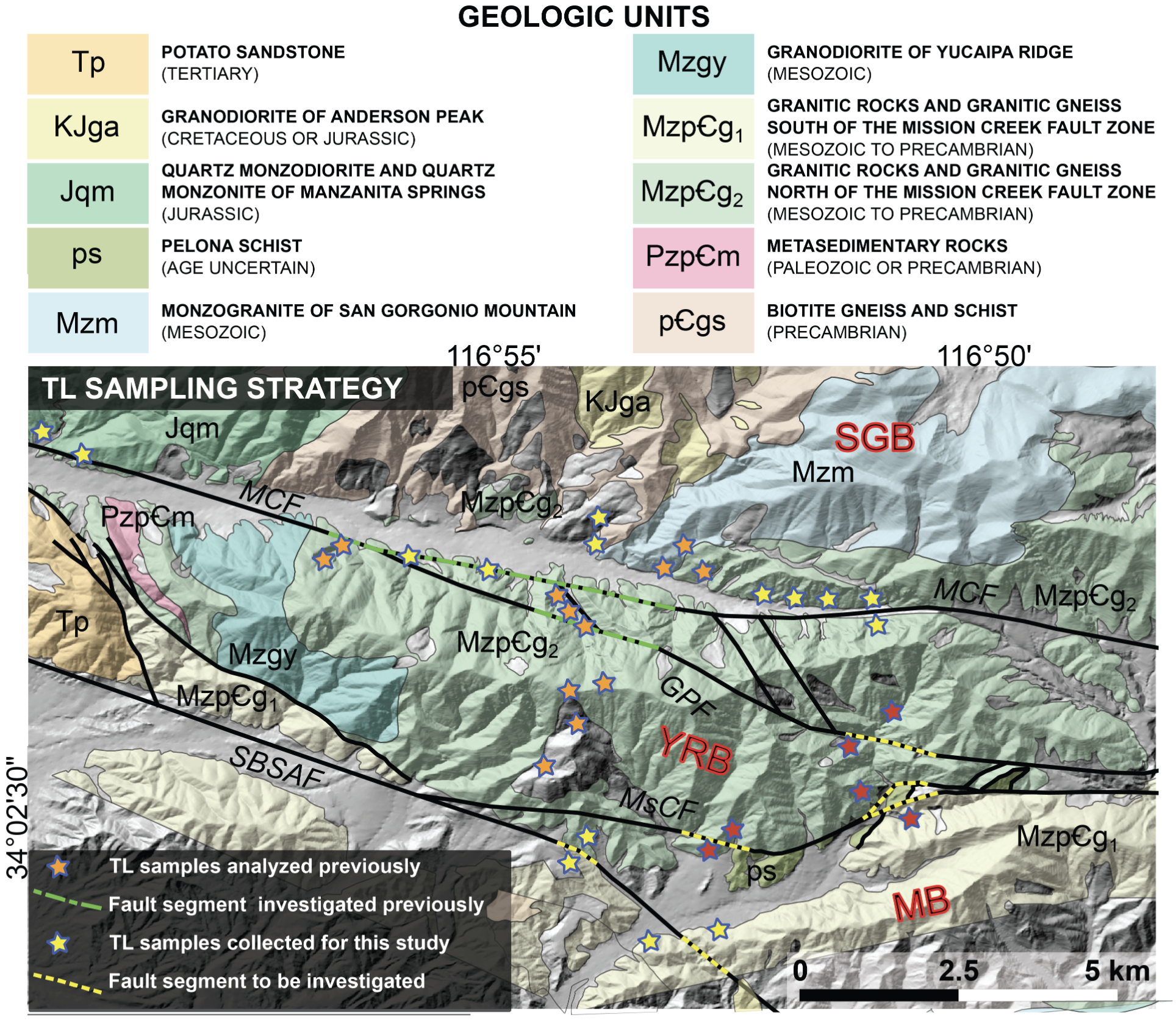
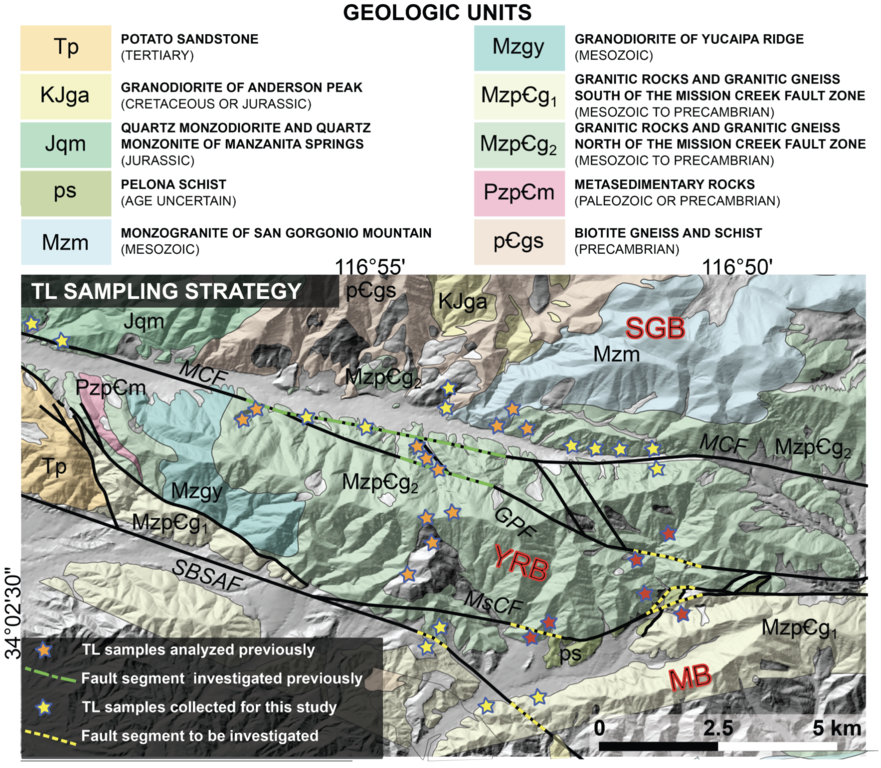
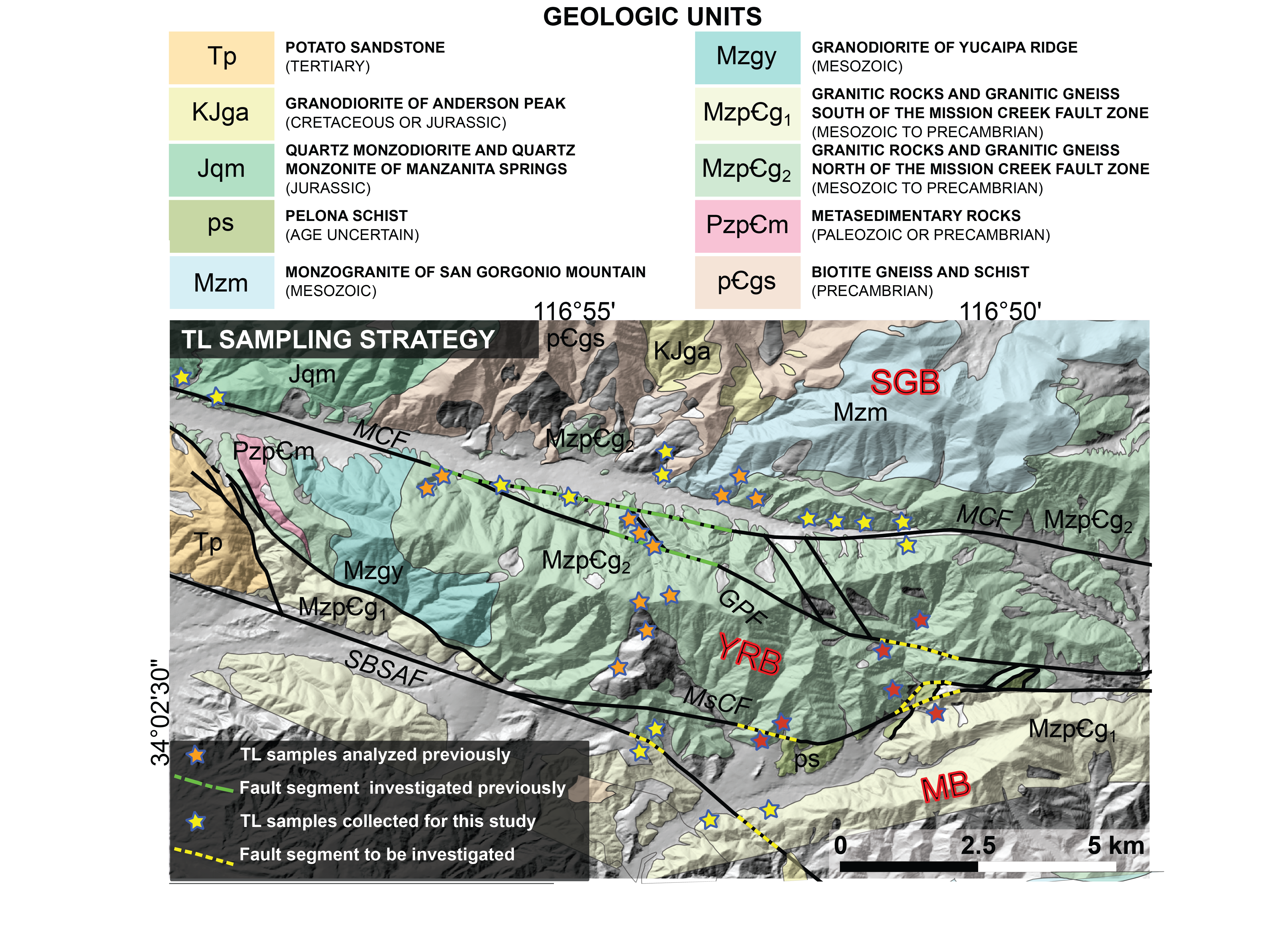
Digital Elevation Model (DEM) of the specified study location, integrating a detailed geologic map to illustrate the sample collection sites in relation to the principal fault structures and lithologic entities within the area. The fault segments are color-coded to identify the particular sections under investigation in the current research. This figure delineates the prominent tectonic blocks, notably the San Gorgonio Block (SGB), Yucaipa Ridge Block (YRB), and Morongo Block (MB), as well as fault systems, including Mill Creek Fault (MCF), Galena Peak Fault (GPF), Mission Creek Fault (MsCF), and San Bernardino San Andreas Fault (SBSAF). The geologic overlay provides a comprehensive spatial context for the sample distribution, offering insights into the complex interplay between the region’s dynamic geological framework and the associated seismic activity.
File history
Click on a date/time to view the file as it appeared at that time.
| Date/Time | Thumbnail | Dimensions | User | Comment | ||
|---|---|---|---|---|---|---|
| delete all | current | 13:17, 18 February 2024 | | 1,928 × 1,680 (3.68 MB) | WikiSysop (talk | contribs) | |
| delete | 16:30, 16 February 2024 | Error creating thumbnail: File with dimensions greater than 12.5 MP | 4,811 × 3,602 (7.56 MB) | Itsajworld1997 (talk | contribs) | Digital Elevation Model (DEM) of the specified study location, integrating a detailed geologic map to illustrate the sample collection sites in relation to the principal fault structures and lithologic entities within the area. The fault segments are color-coded to identify the particular sections under investigation in the current research. This figure delineates the prominent tectonic blocks, notably the San Gorgonio Block (SGB), Yucaipa Ridge Block (YRB), and Morongo Block (MB), as well as... |
You cannot overwrite this file.
File usage
The following page uses this file:
