2025 CSDMS meeting-110
From CSDMS
(if you haven't already)
Log in (or create account for non-CSDMS members)
Forgot username? Search or email:CSDMSweb@colorado.edu
Browse abstracts
Effects of Relief on Headwater Catchment Landscapes
Jongmin Byun,
Seoul National University, South Korea Seoul , Korea, South. cyberzen@snu.ac.kr
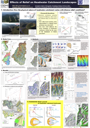
Headwater catchments, primarily composed of hillslopes, valley heads, and colluvial valleys, are vital source areas that supply water, sediments, and nutrients to downstream river networks. Since their landscapes are generally characterized by steep hillslopes and confined, narrow valleys, mass movements dominate these landscapes. However, each catchment must transition at some point from hillslope-dominated to channel-dominated processes. While topographic relief has long been recognized as a key factor influencing these processes and explaining the positions of geomorphic units in headwater catchments, there remains a longstanding debate regarding how valley head locations, often approximated as channel head positions, vary with relief. Further, how does relief influence the lower boundary of headwater catchment, defined by the onset of the dominance of fluvial processes, remains understudied. To address these questions, we identified the valley head locations and the extents of headwater catchments in a drainage basin in South Korea, which spans a wide range of relief. We then quantified the sediment connectivity between valley heads and their upper hillslopes, as well as between headwater catchments and downstream channels, and examined their relationships with relief. Our results revealed an exponential relationship between relief and valley head location, indicating that valley heads shift downslope rapidly with increasing relief. Additionally, we found a positive, non-linear relationship between relief and the lower boundaries of colluvial channels, meaning that an increase in relief enlarges headwater catchment extent exponentially. Consequently, the headwater catchments in high-relief areas exhibit longer hillslopes, valley heads located farther downslope, extended colluvial valleys, and larger headwater catchments compared to those in low-relief areas. Moreover, the sediment connectivity between valley heads and upper hillslopes, as well as between headwater catchment and downstream channels, both were assessed and exhibited positive relationships with relief, respectively. Given the positive correlation of relief with valley head source area, this finding underscores how valley head infilling and subsequent valley head positioning are strongly affected by relief, which has not been fully captured by the stream power-based channel initiation theory that assumes a negative relationship between source area and slope. In addition, the positive relationship of relief with the connectivity of headwater catchment to downstream channels, along with the positive correlation of relief with the lower boundaries of colluvial channels, indicates that relief controls headwater catchment extent by influencing transport capacity-related attributes, including gradient and confinement of colluvial channels and, in turn, debris flow runout distance. Landscape evolution modeling experiments corroborate these findings. This study demonstrates how headwater catchment landscape scales with relief and highlights the fundamental role of topographic relief in controlling headwater catchment geomorphology. These findings advance our understanding of geomorphic processes in headwater catchment and provide practical guidance for managing mountainous environments across diverse topographic conditions.

