2021 CSDMS meeting-137
From CSDMS
Log in (or create account for non-CSDMS members)
Forgot username? Search or email:CSDMSweb@colorado.edu
Browse abstracts
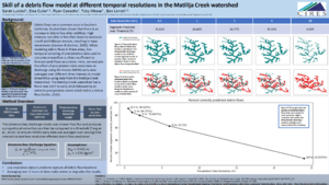
Skill of a debris flow model at different temporal resolutions in the Matilija Creek watershed
Sarah Lundell, Cooperative Institute for Research in Environmental Science at the University of Colorado Boulder (CIRES) Boulder Colorado, United States. sarah.lundell@colorado.edu
Elsa Culler, University of Colorado Boulder Department of Civil, Environmental, and Architectural Engineering (CVEN) and Cooperative Institute for Research in Environmental Science at the University of Colorado Boulder (CIRES) Boulder Colorado, United States. Elsa.Culler@colorado.edu
Ben Livneh, University of Colorado Boulder Department of Civil, Environmental, and Architectural Engineering (CVEN) and Cooperative Institute for Research in Environmental Science at the University of Colorado Boulder (CIRES) Boulder Colorado, United States. ben.livneh@colorado.edu
Ryan Cassotto, Cooperative Institute for Research in Environmental Science at the University of Colorado Boulder (CIRES) Boulder Colorado, United States. ryan.cassotto@colorado.edu
Toby Minear, Cooperative Institute for Research in Environmental Science at the University of Colorado Boulder (CIRES) Boulder Colorado, United States. tminear@colorado.edu
Debris flows, sediment laden gravity driven fluvial processes, are a common issue in Southern California. They often occur during peak streamflow, making precipitation an important predictor for debris flow activity. However, the low temporal sampling of precipitation data used to calculate streamflow is often insufficient to forecast peak flows accurately. Here, we evaluate the effect of precipitation data resolution on discharge using 30-minute IMERG-early data averaged over different time intervals to model streamflow. We apply the results to a dimensionless discharge threshold model to predict debris flow locations. The streamflow values were calculated with the Distributed Hydrology Soil Vegetation Model and the debris flow model was programmed to be compatible with the Basic Model Interface (BMI). BMI was selected for this project because it standardizes model coupling, which enabled a hydrologic driven landslide model to run efficiently. The landslide model follows Tang et al. (2019) to produce dimensionless discharge and debris flow threshold values for stream segments. This can be used to predict where we would likely see a debris flow based on the given streamflow data. We ran these models with precipitation data of different temporal resolutions and evaluated their effect on dimensionless discharge. The model was able to capture a portion of debris flows using higher temporal resolution precipitation data. Of the 138 stream segments evaluated, 122 were predicted to have a dimensionless discharge value above the calculated thresholds when using 30-minute data, which largely matched observations from aerial imagery. In contrast, lower temporal resolution data did not capture these results. Initial debris flow predictions using high resolution precipitation data coincide in stream segments that experienced landslides. We conclude that high resolution precipitation data is critically important for predicting debris flow events.

