Model:AlluvStrat
AlluvStrat
Metadata
|
|
|
Introduction
AlluvStrat is a simple rules-based model that generates fluvial stratigraphy based on channel width and depth, channel migration rate, channel aggradation rate, and an exponential decay constant for levee growth. Channels move directly by lateral migration, or by avulsion once they aggrade a full channel depth (i.e. superelevation = 1). The channels build overbank materials to their sides, and erode overbank materials where they pass through them.
The current boundary conditions force channel positions that would pass through a periodic boundary condition to remain stuck to the domain boundaries; I am curious as to whether or not this matches observations from physical experiments.
History
References
| Nr. of publications: | 1 |
| Total citations: | 0 |
| h-index: | --"--" is not a number. |
| m-quotient: | 0 |
| Featured publication(s) | Year | Model described | Type of Reference | Citations |
|---|---|---|---|---|
|
Wickert, A.D. 2012. AlluvStrat, version 0.1.. , , . 10.1594/IEDA/100088 (View/edit entry) | 2012 | AlluvStrat |
Source code ref. | 0 |
| See more publications of AlluvStrat |
Issues
Help
Input Files
A single plain text file in the directory, called "input", provides parameters for the model. The contents of this file are pasted here:
; Input file for fluvial stratigraphy code (ADW, 27 DEC)

[grid]
dz = 0.1 ; vertical cell size [m]
dy = 1 ; lateral cell size [m]
B = 2001 ; domain width [m]

[time]
dt = 1 ; time step size [yr]
nt = 10000 ; total time steps for model run [--]

[channel]
b = 201 ; meters, must be odd and multiple of dx
h = 5 ; meters
eta = 0 ; Starting bed elevation; should probably stay at zero
etadot_ch = 0.01 ; aggradation rate [m/yr]
zetadot = 1 ; lateral migration rate [m/yr]

[overbank]
; Should include options of different overbank aggradation schemes
etadot_ob_xstar = 200 ; [m] levee exponential decay constant
Output Files
Plots
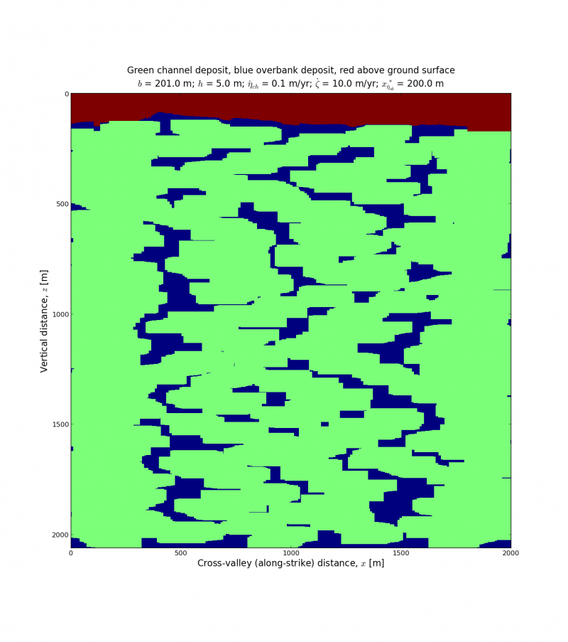
The following are plots of some example output. Relevant parameters are listed in the plots:
- <math>b</math>: Channel width
- <math>h</math>: Channel depth
- <math>\dot{\eta}_{ch}</math>: In-channel aggradation rate
- <math>\dot{\zeta}</math>: Channel lateral migration rate
- <math>x^*_{\dot{\eta}_{ob}}</math>: Floodplain levee height exponential decay length
All of these simulations were run for 10,000 years on a 2001 meter wide domain. Due to the boundary conditions of the current version of the model (trunk on 08 April 2013), there is some clustering of channel bodies around the edges.
Data
The program does not yet save the output grid. We'll have to update the code, or you can run it in an interactive session like ipython and then save the output.


