Topography Data Component
Contributor(s)
Mark Piper at University of Colorado Boulder.
Introduction
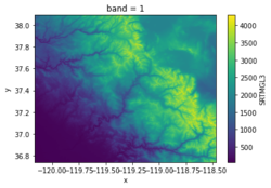

Topography is a Python library to fetch and cache NASA Shuttle Radar Topography Mission (SRTM) and JAXA Advanced Land Observing Satellite (ALOS) land elevation data using the OpenTopography REST API. Topography provides access to the following global raster datasets:
- SRTM GL3 (90m)
- SRTM GL1 (30m)
- SRTM GL1 (Ellipsoidal)
- ALOS World 3D (30m)
- ALOS World 3D (30m, Ellipsoidal)
Classroom organization
This lab includes examples of using the Topography data component in a Jupyter Notebook, in a shell script, and in a Python program. Try editing these example to get data from different locations around the globe.
Learning objectives
Skills
Skills
- TODO
Key concepts
- TODO
Lab notes
This lab can be run on the CSDMS JupyterHub. (If you don't already have an account, follow the instructions to sign up at: https://csdms.colorado.edu/wiki/JupyterHub.) Run the lab notebooks by clicking the "start" link under the Run online heading at the top of this page. If you're an educator using this lab in a class, you can get CSDMS JupyterHub accounts for students. For more information, please contact us through the CSDMS Help Desk: https://github.com/csdms/help-desk.
Requirements
If run locally, see installation instructions in the bmi-topography repository: https://github.com/csdms/bmi-topography.
Acknowledgements
This work is supported by the National Science Foundation under Award No. 2026951, EarthCube Capabilities: Cloud-Based Accessible and Reproducible Modeling for Water and Sediment Research.
References
- Piper, M. (2021). CSDMS Topography data component (Version 0.3.1) (Computer software). https://doi.org/10.5281/zenodo.4608653.
