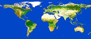
Alldata:GlobCover
From CSDMS
GlobCover dataset information page
Short Description
 |
| Global Land Cover Map V2.3 |
Statement: Global Land Cover Map
Abstract: GlobCover is an ESA initiative which began in 2005 in partnership with JRC, EEA, FAO, UNEP, GOFC-GOLD and IGBP. The aim of the project was to develop a service capable of delivering global composites and land cover maps using as input observations from the 300m MERIS sensor on board the ENVISAT satellite mission. ESA makes available the land cover maps, which cover 2 periods: December 2004 - June 2006 and January - December 2009.
Data format
| Data type: | Land Cover |
| Data origin: | Measured |
| Data format: | GeoTIFF |
| Other format: | |
| Data resolution: | |
| Datum: | WGS84 ellipsoid |
Data Coverage
Spatial data coverage: Global
Temporal data coverage: Time series
Time period covered: 2002 to 2004 and 2009
Availability
Download data: http://due.esrin.esa.int/files/Globcover2009 V2.3 Global .zip
Data source: http://due.esrin.esa.int/page globcover.php
