Alldata:GPW
GPW dataset information page
Short Description
 |
| Gridded Population of the World (2000) |
Statement: Gridded Population of the World
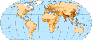
Abstract: Gridded Population of the World, version 3 (GPWv3) is the latest developments in the rendering of human populations in a common geo-referenced framework, produced by the Center for International Earth Science Information Network (CIESIN) of the Earth Institute at Columbia University. GPWv3 depicts the distribution of human population across the globe. It is the most detailed version of GPW to date with more than three times the amount of data as version 2, and includes population estimates to 2015. Developed between 2003 and 2005, GPWv3 provides globally consistent and spatially explicit human population information and data for use in research, policy making, and communications. GPWv3 incorporates a number of improvements to the two prior iterations of GPW. Input administrative data have been improved for nearly all of the 232 countries included in the dataset. (The number of administrative units has increased three-fold since GPWv2 and twenty-fold since GPWv1.) Additionally, the input data years have been updated for over two-thirds of the countries. The population data estimates, previously only available for 1990 and 1995, are also now provided for the period 1990–2015, by quinquennial years. The population estimates for 2005, 2010, and 2015 were produced in collaboration with the United Nations Food and Agriculture Programme (FAO) as GPW: Future Estimates. Finally, the map collection has been vastly expanded to include population density, and sub-national administrative boundary maps at country, continental, and global levels.
Data format
| Data type: | Human dimensions |
| Data origin: | Modeled |
| Data format: | BIL, ArcExport, ASCII |
| Other format: | |
| Data resolution: | 30 arc second (~1km) |
| Datum: |
Data Coverage
Spatial data coverage: Global
Temporal data coverage: Time series
Time period covered: 1990, 1995, 2005, 2010, 2015
Availability
Download data: http://sedac.ciesin.columbia.edu/gpw/global.jsp
Data source: http://sedac.ciesin.columbia.edu/gpw/
