Data:Aerial images Fraser GST: Difference between revisions
From CSDMS
No edit summary |
m (Text replacement - "http://csdms.colorado.edu" to "https://csdms.colorado.edu") |
||
| Line 15: | Line 15: | ||
}} | }} | ||
{{Dataset availability | {{Dataset availability | ||
|Data download link= | |Data download link=https://csdms.colorado.edu/pub/data/AerialImagesFraserGSTZoneLowFlow.zip | ||
|Data source link= | |Data source link=https://csdms.colorado.edu/pub/data/AerialImagesFraserGSTZoneLowFlow.zip | ||
}} | }} | ||
Latest revision as of 17:30, 19 February 2018
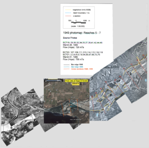
Aerial images Fraser GST dataset information page
Short Description
| Aerial images of Fraser GST zone at low flow (about 700 m3/s) |
Statement: Aerial images of Fraser GST zone
Abstract: Aerial images of Fraser GST zone at low flow (about 700 m3/s). The images and the analysis are associated with the publication "Advance, retreat, and halt of abrupt gravel-sand transitions in alluvial rivers" in Geophysical Research Letters.
Data format
| Data type: | Topography |
| Data origin: | Measured |
| Data format: | |
| Other format: | PNG |
| Data resolution: | |
| Datum: |
Data Coverage
Spatial data coverage: GST zone of Fraser River, CA
Temporal data coverage: Time snap shot
Time period covered:
Availability
Download data: https://csdms.colorado.edu/pub/data/AerialImagesFraserGSTZoneLowFlow.zip
Data source: https://csdms.colorado.edu/pub/data/AerialImagesFraserGSTZoneLowFlow.zip

