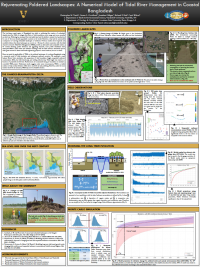
CSDMS 2016 annual meeting poster ChrisTasich
Rejuvenating Poldered Landscapes: A Numerical Model of Tidal River Management in Coastal Bangladesh
Abstract:
The low-lying, coastal region of Bangladesh has relied on poldering (the creation of embanked islands) since the 1960s to mitigate the effects of tidal inundation, storm surge, and, more recently, sea level rise. Poldering has increased the total arable land and the ability to sustain food production for one of the most densely populated countries in the world. However, it has had the unintended consequence of starving embanked landscapes of sediment. Previous studies show empirical and modeled evidence that these landscapes can recover in ~10 years if a direct connection with the tidal channel is restored. Tidal River Management (TRM) provides an alternative and more sustainable solution. To combat declining polder elevations and aggrading channels, some polder inhabitants have attempted TRM to allow water and sediment exchange with the tidal network. Anecdotal reports claim great success for these small-scale engineering projects in some locations, but not in others.
Here, we tested the applicability of TRM on the poldered landscapes of southwest Bangladesh using a numerical model of tidal inundation and subsequent sediment accretion. We employed a mass balance Monte Carlo simulation with parameters of tidal inundation height, suspended sediment concentration (SSC), dry bulk density (ρ), and settling velocity (ws). Tidal height was varied as a function of projected sea level rise. Furthermore, we constrained timing of inundation to simulate a controlled TRM project. Preliminary results suggest, under some circumstances, TRM is a viable solution to help combat elevation offset due to sea level rise and poldering. However, under the most extreme sea level rise scenarios, TRM may not be a feasible solution.
* Please acknowledge the original contributors when you are using this material. If there are any copyright issues, please let us know and we will respond as soon as possible.

