CSDMS 2015 annual meeting poster KatelynWatson
Assessing the water balance of Dry Creek Experimental Watershed via an integrated modeling system
Miguel Aguayo, Boise State University, Idaho, United States.
Alejandro Flores, Boise State University, Idaho, United States.
Abstract:
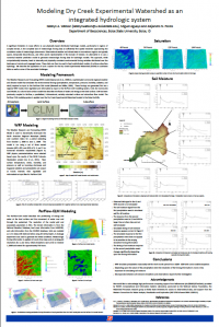
A significant limitation in many efforts to use physically based distributed hydrologic models, particularly in regions of complex terrain, is the complete lack of meteorologic forcing data at sufficiently fine spatial resolution approaching the correlation scales of meteorologic phenomena. Observational weather and climate data in mountainous regions are typically sparse, temporally discontinuous, and often poorly representative of the domain of interest. Increasingly, output from numerical weather prediction models is used as input to these hydrologic models. This approach, while computationally intensive, leads to internally and physically consistent environmental forcing variables distributed over the landscape at remote and ungauged areas. These data can then be used to feed sophisticated models of surface-subsurface hydrology. While an attractive alternative from the perspective of providing spatially and serially complete data, there are a number of unresolved issues associated with this “one-way” coupling of models. In order to explore some of the issues associated with this workflow, we are conducting a series of simulations to integrate an open-source, high spatial-resolution surface-subsurface hydrology model (ParFlow) with the Weather Research Forecasting (WRF) model. WRF is a sophisticated community regional weather and climate model that simulates environmental forcings required as input to the ParFlow model. We apply this modeling system to the Dry Creek Experimental Watershed located in the Boise foothills for the 2009 water year. Precipitation, snow and soil storage, and streamflows are evaluated using observational data from the experimental watershed to assess the performance of the modeling system. Performing these coupled model experiments in this high-relief experimental watershed will allow us to investigate not only the overall performance of the modeling system, but also the influence of varying the spatial resolution of WRF forcing information.
* Please acknowledge the original contributors when you are using this material. If there are any copyright issues, please let us know and we will respond as soon as possible.
