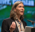
Jaia Syvitski, website username login: Syvitski
|
|
|
University of Colorado, INSTAAR CSDMS 4001 Discovery Drive Boulder, Colorado 80309-0450 United States
|
|
|
|
|
|
|
|
Loading map... {"format":"leaflet","minzoom":false,"maxzoom":false,"limit":50,"offset":0,"link":"all","sort":[""],"order":[],"headers":"show","mainlabel":"","intro":"","outro":"","searchlabel":"... further results","default":"","import-annotation":false,"width":"250px","height":"250px","centre":false,"title":"","label":"","icon":"","lines":[],"polygons":[],"circles":[],"rectangles":[],"copycoords":false,"static":false,"zoom":7,"defzoom":14,"layers":["OpenStreetMap"],"image layers":[],"overlays":[],"resizable":false,"fullscreen":false,"scrollwheelzoom":true,"cluster":false,"clustermaxzoom":20,"clusterzoomonclick":true,"clustermaxradius":80,"clusterspiderfy":true,"geojson":"","clicktarget":"","showtitle":true,"hidenamespace":true,"template":"display_userproperties_map","userparam":"","activeicon":"","pagelabel":false,"ajaxcoordproperty":"","ajaxquery":"","locations":[{"text":"\u003Cb\u003E\u003Ca href=\"/wiki/User:Syvitski\" title=\"User:Syvitski\"\u003ESyvitski\u003C/a\u003E\u003C/b\u003E\u003Chr /\u003E\u003Cp\u003EJaia Syvitski\u003Cbr /\u003E\nUniversity of Colorado, INSTAAR\n\u003C/p\u003E","title":"Syvitski","link":"","lat":40.0149856,"lon":-105.270545,"icon":""}],"imageLayers":[]}
|
Member of the following CSDMS groups
- Marine Working Group
- Terrestrial Working Group
- Coastal Working Group
- Human Dimensions Focus Research Group
Signed up for the mailing list: yes
Professor Jai P.M. Syvitski
Active Positions
Executive Director, of CSDMS — Community Surface Dynamics Modeling System
Fellow, Institute of Arctic and Alpine Research (U. Colorado)
Director, Environmental Computation and Imaging Facility (U. Colorado)
Professor of Geological Sciences (U. Colorado)
Professor of Geophysics (U. Colorado)
Professor of Hydrological Sciences (U. Colorado)
Professor of Oceanography (U. Colorado)
Research Mission
Advance and couple algorithms that describe the earth’s evolving landscape and seascape, and the sedimentary deposits that they create, using advanced computational tools to:
characterize climate-ocean-landscape interactions, across highly dynamic and deforming boundaries,
characterize emergent large-scale behavior of erosion-sedimentation processes operating at small scales,
verify and apply these integrated earth system models to societal issues facing our nation.
CV as of 2023