CSDMS 2016 annual meeting poster AshtonDingle
FREEWAT, a HORIZON 2020 project to build open source tools for water management: the view from a classroom at KU
Laura Foglia, Technical University Darmstadt and University of California Davis California, United States. foglia@geo.tu-darmstadt.de
Iacopo Borsi, Tea Sistemi Pisa , Italy.
Violeta Velasco Mansilla, Idaea-CSIC Barcelona , Spain.
Steffen Mehl, California State University Chico California, United States.
Rudy Rossetto, Scuola Superiore Sant'Anna Pisa , Italy.
Mary Hill, University of Kansas Lawrence Kansas, United States. mchill@ku.edu
Abstract:
FREEWAT is a HORIZON 2020 EU project. FREEWAT’s main result will be an open source and public domain GIS (QGIS) integrated modelling environment for the simulation of water quantity and quality in surface water and groundwater with an integrated water management and planning module. FREEWAT aims to promote water resource management by simplifying the application of the EU Water Framework Directive and related Directives. Specific objectives of the project are to coordinate previous EU and national funded research to integrate existing software modules for water management in a single environment into the GIS based FREEWAT and to support the FREEWAT application in an innovative participatory approach gathering technical staff and relevant stakeholders (policy and decision makers) in designing scenarios for application of water policies. The open source characteristic of the platform creates an initiative "ad includendum", as further institutions or developers may contribute to the development.
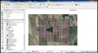
Through creating a common environment among water research/professionals, policy makers, and implementers, FREEWAT’s main impact will be on enhancing a science- and participatory approach and evidence-based decision making in water resource management, hence producing relevant and appropriate outcomes for policy implementation which is critical for sustainable management of water resources. Here we discuss the use of FREEWAT in a US classroom at the University of Kansas. The image below shows the FREEWAT work environment.

The surface water modeling exercise considered
in a class at KU illustrates the integration of FREEWAT with QGIS.
* Please acknowledge the original contributors when you are using this material. If there are any copyright issues, please let us know and we will respond as soon as possible.
