Data:HYDRO1k
HYDRO1k dataset information page
Short Description
 |
| HYDRO1k Elevatioin Derivative Database |
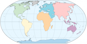
Statement: HYDRO1k is a geographic database providing comprehensive and consistent global coverage of optographically derived data sets.
Abstract: HYDRO1k is a geographic database developed to provide comprehensive and consistent global coverage of topographically derived data sets, including streams, drainage basins and ancillary layers derived from the USGS' 30 arc-second digital elevation model of the world (GTOPO30). HYDRO1k provides a suite of geo-referenced data sets, both raster and vector, which will be of value for all users who need to organize, evaluate, or process hydrologic information on a continental scale.
Developed at the U.S. Geological Survey's Center for Earth Resources Observation and Science (EROS), the HYDRO1k project's goal is to provide to users, on a continent by continent basis, hydrologically correct DEMs along with ancillary data sets for use in continental and regional scale modeling and analyses.
Data format
| Data type: | Hydrography |
| Data origin: | |
| Data format: | BIL, ArcExport |
| Other format: | |
| Data resolution: | 1 km resolution |
| Datum: |
Data Coverage
Spatial data coverage: Global
Temporal data coverage: Time snap shot
Time period covered:
Availability
Download data: http://eros.usgs.gov/#/Find Data/Products and Data Available/gtopo30/hydro
Data source: http://eros.usgs.gov/#/Find Data/Products and Data Available/gtopo30/hydro
