Model:Gc2d: Difference between revisions
m removed old questionnaire information. Replaced with form |
No edit summary |
||
| Line 27: | Line 27: | ||
|Categories=Terrestrial | |Categories=Terrestrial | ||
|Spatial dimensions=2D | |Spatial dimensions=2D | ||
|One-line model description=Glacier / ice sheet evolution model | |One-line model description=Glacier / ice sheet evolution model | ||
|Extended model description=Models the growth and evolution of valley glaciers and ice sheets | |Extended model description=Models the growth and evolution of valley glaciers and ice sheets | ||
}} | }} | ||
{{Model technical information | {{Model technical information | ||
| Line 46: | Line 46: | ||
}} | }} | ||
{{Input - Output description | {{Input - Output description | ||
|Describe input parameters=Landscape elevation, ELA with time | |Describe input parameters=Landscape elevation, ELA with time | ||
|Other input format=Matlab .mat files | |Other input format=Matlab .mat files | ||
|Describe output parameters=Glacier thickness and elevation | |Describe output parameters=Glacier thickness and elevation | ||
|Other output format=Matlab .mat files | |Other output format=Matlab .mat files | ||
|Pre-processing software needed?=No | |Pre-processing software needed?=No | ||
| Line 55: | Line 55: | ||
}} | }} | ||
{{Process description model | {{Process description model | ||
|Describe processes represented by the model=Glacier growth and evolution | |Describe processes represented by the model=Glacier growth and evolution | ||
|Describe length scale and resolution constraints=kilometers | |Describe length scale and resolution constraints=kilometers | ||
|Describe time scale and resolution constraints=Tens to hundreds of years | |Describe time scale and resolution constraints=Tens to hundreds of years | ||
}} | }} | ||
{{Model testing | {{Model testing | ||
| Line 68: | Line 68: | ||
}} | }} | ||
{{Documentation model | {{Documentation model | ||
|Provide key papers on model if any=Kessler, et al., 2006 (doi:10.1029/2005JF000365) | |Provide key papers on model if any=Kessler, et al., 2006 (doi:10.1029/2005JF000365) | ||
Mark A. Kessler, Robert S. Anderson, Jason P. Briner, 2008. Fjord insertion into continental margins driven by topographic steering of ice. Nature Geoscience 1, 365-369 (11 May 2008) doi:10.1038/ngeo201 Letter | |||
|Manual model available=No | |Manual model available=No | ||
}} | }} | ||
Revision as of 15:54, 26 April 2010
Contact
| Name | Mark Kessler |
| Type of contact | Model developer |
| Institute / Organization | University of Colorado |
| Postal address 1 | 1560 30th street |
| Postal address 2 | |
| Town / City | Boulder |
| Postal code | 80305 |
| State | Colorado |
| Country | USA"USA" is not in the list (Afghanistan, Albania, Algeria, Andorra, Angola, Antigua and Barbuda, Argentina, Armenia, Australia, Austria, ...) of allowed values for the "Country" property. |
| Email address | mark.kessler@colorado.edu |
| Phone | |
| Fax |
| Name | Eric Hutton |
| Type of contact | Technical contact |
| Institute / Organization | CSDMS, INSTAAR, University of Colorado |
| Postal address 1 | 1560 30th street |
| Postal address 2 | |
| Town / City | Boulder |
| Postal code | 80305 |
| State | Colorado |
| Country | USA"USA" is not in the list (Afghanistan, Albania, Algeria, Andorra, Angola, Antigua and Barbuda, Argentina, Armenia, Australia, Austria, ...) of allowed values for the "Additional country" property. |
| Email address | huttone@colorado.edu |
| Phone | |
| Fax |
Gc2d
Metadata
Summary
Technical specs
In/Output
Process
Testing
Other
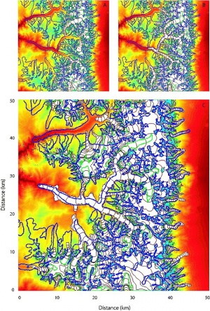
Introduction gc2d a two-dimensional finite difference numerical model that simulates the formation and evolution of temperate valley glaciers on a two-dimensional topographic surface with a specified meteorological setting. Driven by a time series of mass balance (snow precipitation - melt rate), the model calculates ice surface elevations above a two-dimensional terrain by solving equations for ice flux and mass conservation using explicit methods. A number of other authors have employed one- and two-dimensional models based on similar sets of equations. However, gc2d integrates glacier and climate simulation components explicitly, and thus has the unique ability to simulate feedbacks between the changing ice surface and the climate forcing. In addition, the framework of this model permits the inclusion of discrete processes that modify the ice distribution, such as avalanching on steep terrain. The efficiency of this model allows simulation of glacial evolution over millennial timescales at spatial scales that resolve valley glaciers. Finally, from a computational standpoint, the simplicity of this model permits the investigation of significant regions of parameter space, allowing us to determine the effect of new processes or altered algorithms for them. The above description is taken almost verbatim from Kessler et al. (2006) [1]. References
HistoryIssuesHelpInput FilesOutput FilesDownloadSourceCommand-Line AccessIf you plan to make changes, use this command to check out the code as yourself using HTTPS: # Project members authenticate over HTTPS to allow committing changes.
svn checkout https://csdms.colorado.edu/svn/gc2dWhen prompted, enter your CSDMS Subversion password. Non-members may only check out a read-only working copy of the project source. To obtain a CSDMS Subversion account or to become a member of this project, please email csdms@colorado.edu. GUI and IDE AccessThis project's Subversion repository may be accessed using many different client programs and plug-ins. See your client's documentation for more information. https://csdms.colorado.edu/svn/gc2d Subversion HelpFor help on how to use Subversion, an excellent manual is available online at http://svnbook.red-bean.com/ |
