Model:Sedflux: Difference between revisions
m removed contents, is all on the trac page |
No edit summary |
||
| Line 13: | Line 13: | ||
{{Model identity | {{Model identity | ||
|Model type=Modular | |Model type=Modular | ||
|Categories=Coastal, Marine | |Categories=Model domain, Coastal, Marine | ||
|Spatial dimensions=2D, 3D | |Spatial dimensions=2D, 3D | ||
|One-line model description=Basin filling stratigraphic model | |One-line model description=Basin filling stratigraphic model | ||
|Extended model description=Sedflux-2.0 is the newest version of the Sedflux basin-filling model. Sedflux-2.0 provides a framework within which individual process-response models of disparate time and space resolutions communicate with one another to deliver multi grain sized sediment load across a continental margin. | |Extended model description=Sedflux-2.0 is the newest version of the Sedflux basin-filling model. Sedflux-2.0 provides a framework within which individual process-response models of disparate time and space resolutions communicate with one another to deliver multi grain sized sediment load across a continental margin. | ||
}} | }} | ||
{{Model technical information | {{Model technical information | ||
| Line 35: | Line 35: | ||
|Describe input parameters=River mouth characteristics (velocity, width, depth, concentration) averaged daily, or longer. | |Describe input parameters=River mouth characteristics (velocity, width, depth, concentration) averaged daily, or longer. | ||
Initial bathymetry. Input sediment distribution and properties of each grain type. Optionally, any of: tectonics, sea level, wave climate, and currents | Initial bathymetry. Input sediment distribution and properties of each grain type. Optionally, any of: tectonics, sea level, wave climate, and currents | ||
|Input format=ASCII | |Input format=ASCII | ||
|Describe output parameters=Sediment properties that include (but are not limited to) bulk density, grain size, porosity, and permeability. These are averaged over are user-specified vertical resolution (typically mm to cm). | |Describe output parameters=Sediment properties that include (but are not limited to) bulk density, grain size, porosity, and permeability. These are averaged over are user-specified vertical resolution (typically mm to cm). | ||
Sea-floor properties that include slope, water depth, and sand fraction. | Sea-floor properties that include slope, water depth, and sand fraction. | ||
|Output format=Binary | |Output format=Binary | ||
|Pre-processing software needed?=No | |Pre-processing software needed?=No | ||
| Line 47: | Line 47: | ||
}} | }} | ||
{{Process description model | {{Process description model | ||
|Describe processes represented by the model=surface plumes, hyperpycnal plumes, sediment slope failure that results in turbidity currents or debris flows, subsidence, compaction, sediment remobilization due to waves and currents, river avulsion | |Describe processes represented by the model=surface plumes, hyperpycnal plumes, sediment slope failure that results in turbidity currents or debris flows, subsidence, compaction, sediment remobilization due to waves and currents, river avulsion | ||
|Describe key physical parameters and equations=Too numerous to list. | |Describe key physical parameters and equations=Too numerous to list. | ||
|Describe length scale and resolution constraints=Vertically: mm to cm; Horizontally: 10s of m to 1000 of m | |Describe length scale and resolution constraints=Vertically: mm to cm; Horizontally: 10s of m to 1000 of m | ||
|Describe time scale and resolution constraints=Days or greater. Component processes can have much higher resolutions for numerical stability. | |Describe time scale and resolution constraints=Days or greater. Component processes can have much higher resolutions for numerical stability. | ||
|Describe any numerical limitations and issues=-- | |Describe any numerical limitations and issues=-- | ||
}} | }} | ||
Revision as of 12:04, 16 November 2009
Contact
| Name | Eric Hutton |
| Type of contact | Model developer |
| Institute / Organization | CSDMS, INSTAAR, University of Colorado |
| Postal address 1 | 1560 30th street |
| Postal address 2 | |
| Town / City | Boulder |
| Postal code | 80305 |
| State | Colorado |
| Country | USA"USA" is not in the list (Afghanistan, Albania, Algeria, Andorra, Angola, Antigua and Barbuda, Argentina, Armenia, Australia, Austria, ...) of allowed values for the "Country" property. |
| Email address | huttone@colorado.edu |
| Phone | |
| Fax |
Sedflux
Metadata
Summary
Technical specs
In/Output
Process
Testing
Other
sedflux-2.0 [1] [2]
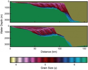
Sedflux-2.0 is the newest version of the Sedflux basin-filling model. Sedflux-2.0 provides a framework within which individual process-response models of disparate time and space resolutions communicate with one another to deliver multi grain sized sediment load across a continental margin. Version 2.0 introduces a series of new process models, and the ability to operate in one of two modes to track the evolution of stratigraphy in either two or three dimensions. Additions to the 2D-mode include the addition of models that simulate
New processes in the 3D-mode include
The spatial resolution of the architecture is typically 1-25 cm in the vertical, and 10-100 m in the horizontal when operating in 2D-mode. In 3D-mode, the ....
References
|

