CSDMS meeting 2018: Difference between revisions

From CSDMS
No edit summary
No edit summary
Line 113: Line 113:
==Posters==
==Posters==
{{Header_CSDMS_meeting_abstract_list1}}
{{#ask:[[Annualmeeting:+]] [[Category:CSDMS meeting 2018 participants]] [[CSDMS meeting abstract submit::Yes]]
{{#ask: [[Category:CSDMS meeting 2018 participants]] [[CSDMS meeting abstract submit::Yes]]
| ?CSDMS meeting first name
| ?CSDMS meeting first name
| ?CSDMS meeting last name
| ?CSDMS meeting last name

Revision as of 15:30, 13 May 2018

Presentations and more of the joined CSDMS - SEN 2018 annual meeting

Geoprocesses, geohazards - CSDMS 2018

May 22-24th 2018 in Boulder Colorado, USA


Thank You

On behalf of CSDMS, we thank the Keynote Speakers, Clinic Leaders, Session Chairs, Poster Session Presenters, members of the Executive and Steering Committees, and every participant who helped to make this a productive and successful meeting.

Agenda

Click here to view the final agenda

Presentations

Keynote talks

Presented by Title
Brad Murray Welcome
Greg Tucker Introduction to the Natural Hazards Modeling WS
Susan Cutter Social Vulnerability and Community Resilience to Natural Hazards: Models, Tools, and Practice
David George Modeling earth-surface flow hazards with D-Claw
Paul Bates Modelling flood risk in the continental US
Julio Hoffiman Mendes ImageQuilting.jl: A code for generating 3D stratigraphy from data collected in flume experiments
Rachel Glade Modeling blocky hillslope evolution in layered landscapes
Mike Willis Private Eyes are Watching You
Phaedra Upton Earthquake-induced landslides and landscape dynamics: The 2016 Kaikōura Earthquake and response
Chris Jenkins Scale- and Process-Jumps in a Multimodel Project on Hurricane Impacts at the Seabed
Jenny Suckale Multiphase instabilities and extreme events in different natural systems
Robert Weiss Simulating the tsunami hazard: quantitative predictions
Jannis Hoch GLOFRIM – A globally applicable framework for integrated hydrologic-hydrodynamic modeling
Joannes Westerink Storm surge model ADCIRC for risk assessment
Joel Johnson Using tsunami sediment transport experiments to improve paleohydraulic inverse models
Terry Idol Disasters: Increasing Interoperability for User-driven State-of-the-Art Data and Models

Clinics

Presented by Title
Irina Overeem Permafrost Toolbox
Sediment Experimentalist Network (SEN) Sediment Experimentalist Network (SEN) - Wrangling your research data
Guy Schumann and Jeffrey Neal LISFLOOD-FP Clinic: Introduction to Flood Hazard Modeling
Steve Roberts and Mariela Perignon Hydrodynamic modeling using the open source package ANUGA
Mark Piper BMI Live!
Nicole Gasparini Landlab with Hydroshare
Katy Barnhart Model sensitivity analysis and optimization with Dakota and Landlab
Cam Wobus and Mark Lorie Physical and Socio-Economic Data for Natural Hazards
Doug Edmonds and Samapriya Roy An Introduction to using Google Earth Engine
Ethan Gutmann Making Use of Climate Model Output: Downscaling for Regional Applications
Chris Jenkins and Jeff Obelcz Forum on Artificial Intelligence & Machine Learning: What lies ahead for Earth Surface Modeling?
Chris Sherwood How to make accurate digital elevation models using imagery from drones
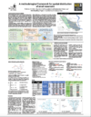
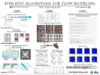
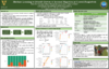
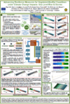
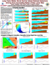
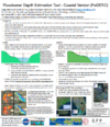
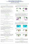
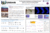
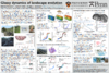
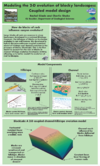
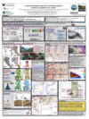
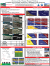
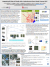
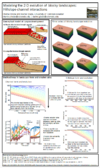
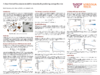
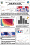
Posters

NameAbstract titlePoster
Antolini, Federico A framework proposal for spatial distribution of small reservoirs
Ashley, Thomas Statistical Bedload Modeling on the Colorado River in Grand Canyon National Park
Barnes, Richard Efficient Parallel Algorithms For Terrain Analysis
Best, Kelsea Machine Learning to Identify Drivers of Internal Migration in Coastal Bangladesh
Best, Üwe Modelling Wave Action, Surges, Morphodynamics and Vegetation Dynamics: Do Salt Marsh & Mangrove Fringe Coastlines Survive Sea Level Rise?
Calhoun, Donna ForestClaw : A parallel, adaptive Cartesian grid library for problems in geophysical hazards modeling
Callaghan, Kerry Coupled groundwater and surface water modelling to visualise lake extent and total terrestrial water storage under a changing climate
Campforts, Benjamin Landslides in long term landscape evolution models
Chadwick, Austin Predicting the location of avulsion hazards on deltas in the face of changing discharge regimes and relative sea-level rise
Chen, Yunxiang conduitFoam: a one-dimensional subglacial conduit mode
Ciarletta, Daniel Long Term Risks: Novel Barrier Island Retreat Behaviors Arising from Increasing Rates of Sea Level Rise
Cohen, Sagy The Floodwater Depth Estimation Tool (FwDET)
Davis, Brisa Targeted Adaptive Mesh Refinement for Tsunami Modeling Using Adjoint Equations
Del Vecchio, Joanmarie Using relict Pleistocene geomorphology to inform future permafrost change
Duan, Jennifer Impact of Climate Change on Flood Frequency Curve: Santa Cruz River Case Study
Ferdowsi, Behrooz Glassy dynamics of landscape evolution
Ferrier, Ken Transient relationships between chemical and physical erosion rates in regolith-mantled topography
Glade, Rachel Modeling the 2-D evolution of blocky landscapes: Coupled model design
Hoffimann, Julio ImageQuilting.jl: A code for generating 3D stratigraphy from data collected in flume experiments
Istanbulluoglu, Erkan A hydroclimatological approach to predicting regional landslide probability using Landlab
Janoff, Arye A Coastal Geo-economic Model: Property Protection, Federal Buyouts, and Managed Retreat
Kochanski, Kelly Statistical classification of self-organized snow surfaces
Kolodin, Jesse Investigating Artificial Berm-Dune Management Along New Jersey’s Coastline Using a Coupled Geo-Economic Model
Kozlowski, Estanislao Multi-scale modelling of microbial lacustrine carbonates with Carbo-CAT and Mounds3D
Leonarduzzi, Elena Towards a landslide warning concept for Switzerland using rainfall thresholds and multi-scale hydrological modeling
Li, Jin Influence of wave-induced currents on sediment transport and coral growth of atolls
Li, Jiao Embedding Seawall Models in Coastal Flooding Simulations
Lyons, Nathan Coupled models of landscape and species evolution
Morris, Chloe The Coastline Evolution Model 2D (CEM2D)
Nienhuis, Jaap Can barrier islands survive sea level rise? Tidal inlets versus storm overwash
Obelcz, Jeffrey Towards a Quantitative Understanding of Parameters Driving Submarine Slope Failure: A Data Mining and Machine Learning Approach
Pfeiffer, Allison How do source-to-sink geomorphic processes mediate flood hazards? Using historical changes to inform predictions
Phillips, Colin Coupling fine particle transport, storage, and remobilization with sediment bed morphodynamics
Pérez-Hincapié, Ana María Comparative geomorphological analysis applied to the hazard assessment of debris flows in three watersheds of the Western Cordillera of Colombia
Qin, Xinsheng Accelerating Block-Structured Adaptive Mesh Refinement (AMR) with GPUs
Qureshi, Huda A Sensitivity Analysis of the Effect of Parametric Wind Model Inputs on Hurricane Storm Surge Simulations
Richmond, Nick 3D Bedrock Channel Evolution with Smoothed Particle Hydrodynamics Coupled to a Finite Element Earth
Schumann, Guy Integrating EO Data of Floods with a Hydrodynamic Event Model: Harvey 2017
Shobe, Charles Modeling the 2-D evolution of blocky landscapes: Hillslope-channel interactions
Sincavage, Ryan Deterioration of the eastern margin of the Colonia Glacier, northern Patagonia: the end of a glacially-dammed alpine lake?
Southard, Paul Impact of spring-associated riparian vegetation on channel morphology in ephemeral dryland channels: Henry Mountains, Utah, USA
Strom, Kyle A simple, single-size and time-dependent flocculation model
Tang, Hui Physics-informed machine learning approach for predicting post-fire debris flows based on thresholds
Wang, Kang Effect of Enhanced Cold-Season Climate Warming on Permafrost Temperatures
Wickert, Andrew Long-profile evolution of transport-limited gravel-bed rivers
Yanites, Brian Quantitative constraints on landslide frequency through the use of cosmogenic nuclides: a numerical modeling perspective


Meeting photos