Images portal: Difference between revisions
From CSDMS
m improved text a bit |
No edit summary |
||
| (One intermediate revision by the same user not shown) | |||
| Line 1: | Line 1: | ||
{{PageTitle|Images}} | |||
The images on this page illustrate aspects of environments that the CSDMS Project tries to capture by a suite of models. The freely downloadable images are generously contributed by various people. Please make sure to credit the contributors when you are using these images. | The images on this page illustrate aspects of environments that the CSDMS Project tries to capture by a suite of models. The freely downloadable images are generously contributed by various people. Please make sure to credit the contributors when you are using these images. | ||
Latest revision as of 18:06, 26 January 2017
Images
The images on this page illustrate aspects of environments that the CSDMS Project tries to capture by a suite of models. The freely downloadable images are generously contributed by various people. Please make sure to credit the contributors when you are using these images.
| Images | |
|---|---|
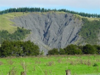 |
Terrestrial
Images of meandering rivers, braided rivers , dams and reservoirs, flooding, irrigation, land slides, thaw lakes, etc. |
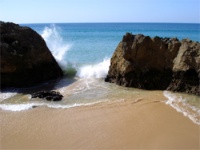 |
Coastal
This gallery contains images of spits, tidal flats, deltas, coastal defenses, coastal erosion, etc. |
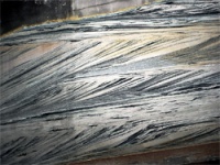 |
Marine
Images of experimental stratigraphy. |
