Wildfire TWG-subgroup: Difference between revisions
From CSDMS
Created page with "=Wildfire Terrestrial Subgroup=" |
No edit summary |
||
| (16 intermediate revisions by 3 users not shown) | |||
| Line 1: | Line 1: | ||
=Wildfire Terrestrial Subgroup= | =Wildfire Terrestrial Subgroup= | ||
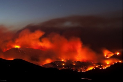
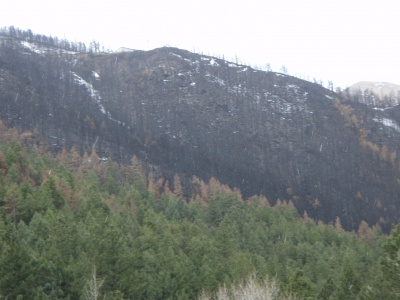
[[File:FourmilefromFlagstaff.jpg|400px]][[File:013.JPG|400px]] | |||
<br /> | |||
Fourmile Canyon Wildfire | |||
'''Data Available''' | |||
* Fourmile Canyon Wildfire: Terrestrial LiDAR, rainfall, runoff ([[TempMap|See map for extend of the fire]]) | |||
* Spring Creek: Cross-Section Topography, Airborne LiDAR, rainfall, runoff | |||
* Horseshoe 2 Wildfire: Terrestrial LiDAR, rainfall | |||
'''Data Needs''' | |||
'''Models Needed in CSDMS''' | |||
*Wildfire/Vegetation Models: | |||
'''Models Available in CSDMS''' | |||
*Hydrology: [[Model:TopoFlow|TopoFlow]] | |||
*Erosion: [[Model:TopoFlow|TopoFlow]]? | |||
'''Interested members'''<br> | |||
(''Put your name down at the list if you would like to join this subgroup'') | |||
* [[User:Frengers|Francis Rengers]] | |||
'''Bibliography''' | |||
'''Resources''' | |||
* http://www.openwfm.org/wiki/Main_Page | |||
Latest revision as of 17:36, 10 January 2014
Wildfire Terrestrial Subgroup
Data Available
- Fourmile Canyon Wildfire: Terrestrial LiDAR, rainfall, runoff (See map for extend of the fire)
- Spring Creek: Cross-Section Topography, Airborne LiDAR, rainfall, runoff
- Horseshoe 2 Wildfire: Terrestrial LiDAR, rainfall
Data Needs
Models Needed in CSDMS
- Wildfire/Vegetation Models:
Models Available in CSDMS
Interested members
(Put your name down at the list if you would like to join this subgroup)
Bibliography
Resources


