File:Picture1.png: Difference between revisions
From CSDMS
Discharge (m3/s) at USGS gauge 07360200 (top), Flooded map (m) (left) and Flow velocity (m/s) in 3-Dimensional view (right) |
(No difference)
|
Latest revision as of 18:32, 30 January 2013
Discharge (m3/s) at USGS gauge 07360200 (top), Flooded map (m) (left) and Flow velocity (m/s) in 3-Dimensional view (right)
File history
Click on a date/time to view the file as it appeared at that time.
| Date/Time | Thumbnail | Dimensions | User | Comment | ||
|---|---|---|---|---|---|---|
| delete all | current | 18:32, 30 January 2013 | 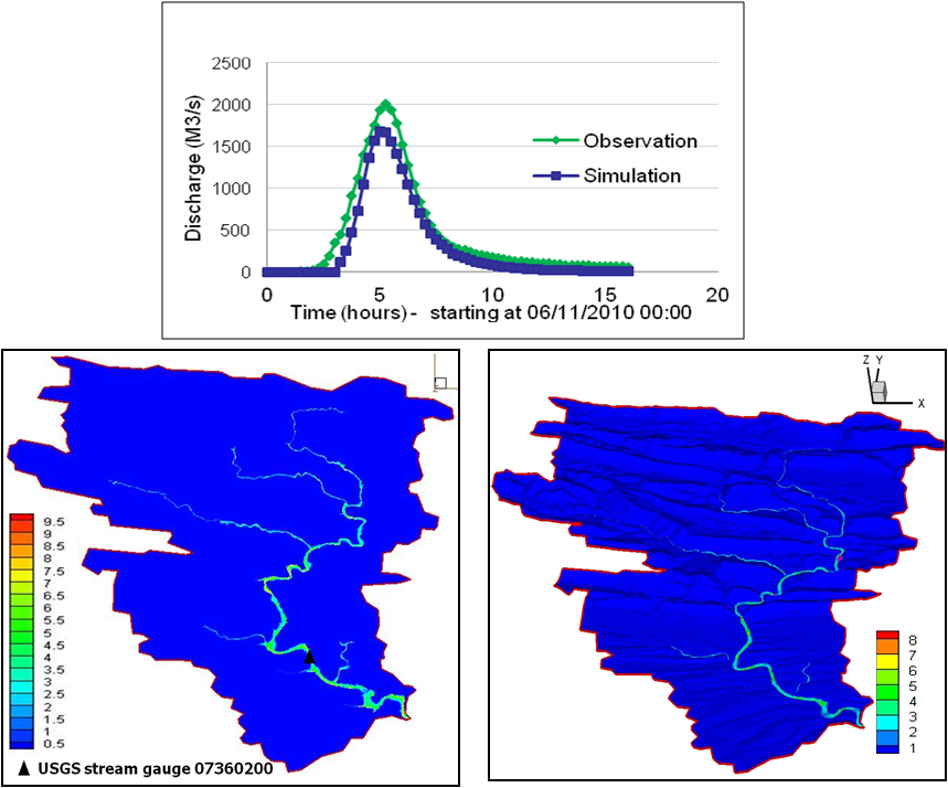 | 859 × 714 (336 KB) | Ndphu (talk | contribs) | Discharge (m3/s) at USGS gauge 07360200 (top), Flooded map (m) (left) and Flow velocity (m/s) in 3-Dimensional view (right) |
You cannot overwrite this file.
File usage
The following 2 pages use this file:
