Surface properties data
From CSDMS
Surface properties data descriptions
This is an automatically generated table.
Want to add your dataset to this list? Please complete this data form first. Feel free to contact us CSDMSweb@colorado.edu or use the wiki and follow one of the dataset links if you want to update the information about a dataset that is already listed.
There are 9 datasets described below.
| Dataset info | Type | Origin | Description | Data example |
|---|---|---|---|---|
| Experimentalist Data Catalog | Surface properties | Measured | Experimental datasets offered by the Sediment Experimentalist Network |  |
| GLiM | Surface properties | Measured | Global Lithological Map | 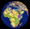 |
| GSHAP | Surface properties | Measured | Global Seismic Hazard Assessment Program | |
| HWSD | Surface properties | Measured | Harmonized World Soil Database (HWSD) | |
| NCED data repository | Surface properties | Measured | Data from or related to the National Center for Earth-surface Dynamics (NCED) |  |
| RESSED | Surface properties | Measured | The Reservoir Sedimentation Database |  |
| SSURGO | Surface properties | Measured | SSURGO (Soil Survey Geographic database) refers to digital soils data produced and distributed by the Natural Resources Conservation Service (NRCS) - National Cartography and Geospatial Center (NCGC). | 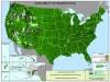 |
| STATSGO | Surface properties | Measured | The U.S. General Soil Map | 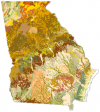 |
| SoilGrids — global gridded soil information | Surface properties | Measured | SoilGridsTM is a system for global digital soil mapping that uses state-of-the-art machine learning methods to map the spatial distribution of soil properties across the globe. |
