Labs WMT Hydrology Meteo
Hydrology Modeling - Energy Budget
Classroom organization
If you have never used the Web Modeling Tool, learn how to use it here. The WMT allows you to set up simulations, but once you are ready to run them, you will need an account on the CSDMS supercomputer to submit your job.
More information on getting an account can be found here HPCC Access
This lab is the first in a series of hydrology labs, it will likely take ~ 3hours to complete fully. These labs use TOPOFLOW components to simulate basic hydrological processes such as the energy budget, precipitation, snowmelt, evaporation, infiltration etc.
These TOPOFLOW components are designed to be coupled and to model water runoff in a landscape, i.e. in a 'spatially-distributed' hydrological model.
Lecture notes discuss variation of incoming radiation with latitude and time of the year (download the presentation slides here).
In this lab focus is on the solar radiation for a given watershed. We will model incoming radiation and look at the effect of watershed morphometric properties: slope and aspect.
Learning objectives
- relation between temperature incoming solar radiation
- importance of watershed slope, aspect
Key concepts
- Stefan-Boltzmann Law
- Geometric relationship between Earth's tilt, day of year and local slope, aspect
Based on the presentation slides work on the following problem:
What would be the mean annual temperature of Earth without an atmosphere if the present albedo (roughly 0.3) would increase to 0.4?
Discuss whether this could be a reasonable increase of albedo for a warming planet?
Lab Notes
>> Open a new browser window and open the Web Modeling Tool WMT with hydrology components
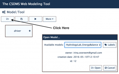
>> For this Energy Budget exercise we will start out with an example called 'HydrologyLab_EnergyBalance1'
>> The Meteorology Component will now be active in the WMT. You can browse through the Parameter List and learn how this simulation is set up. This is an basic run for a watershed in Kentucky, called Beaver Creek.
The watershed slopes, and aspects have been pre-calculated from a 1108 rows by 1207 columns DEM for this region.
We will calculate the meteorological conditions (with most of the parameters set by just single values). Our run calculates the pattern of incoming radiation for March 1st, for 12 hours.
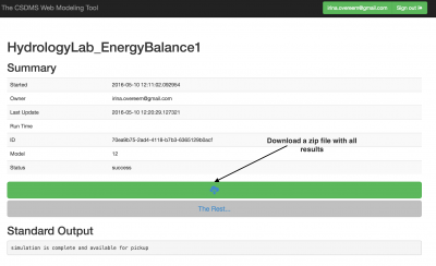
Once you have explored the input, you have to save this configuration as a personal example. Then, you can run it by hitting the arrow run button. This way you generate a job script that can be submitted to Beach-the CSDMS High Performance Computing System. Provide your Beach account information (i.e. user name and password) to get the run started. The status page allows you to keep track of a simulation. From the status page you can eventually download your output files.

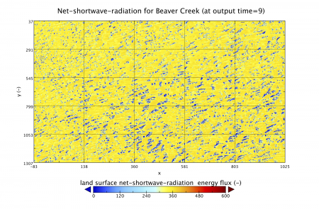
The model simulation output is presented in the netcdf file called 'land-surface_net_shortwave_radiation_energry_flux'. For the questions you wl also use the files 'land-surface_aspect_angle.nc' and 'land_surface_slope_angle.nc'.
You can plot these output files in Panoply.
What is the maximum incoming net shortwave radiation in Beaver Creek for this specific 12 hour simulation?
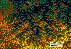
The hilly incised landscape of Beaver Creek is shown from the DEM on the left, there is about 500m of relief between the stream beds and the highest hillslope tops. The figure on the left is a plot of t=9 hrs into the total simulation and shows the distribution of incoming radiation over the landscape.
Can you predict the differences of incoming radiation for different aspects? Plot up at least 3 different time series of varying aspect angles (N, W, S).
Can you predict the differences of incoming radiation for different slopes? Compare the incoming radiation for a gridcell with a very low slope angle versus a steep slope gridcell.
Using the simulation settings of the example, design two additional simulations. One that runs at the summer solstice and one for the winter solstice
Quantify the differences between the winter and summer solstice for the Beaver Creek watershed.
Discuss how radiation would change if we would be studying a watershed at 70 degrees North? Or one watershed at the equator?
The implications of slope and aspect on the hydrological balance are mostly through evaporation and soil moisture.
Discuss how differences in vegetation on a south-facing slope versus a north-facing slope can possibly affect runoff.


