Lab-0026
Linking Landlab Components and Creating Sediment Pulses in NetworkSedimentTransporter
Contributor(s)

Classroom organization
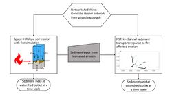
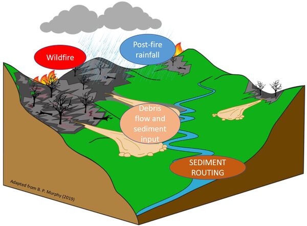
Sediment pulses are synthetically introduced to simulate erosive conditions, which may be caused by fire or landslide occurrences in the landscape, to quantify sediment yield across river network using the Landlab NetworkSedimentTransporter (NST) component.
Download associated file: ESPIN2021 project Creating sediment input into Landlab Network Sediment Transporter.pptx
Skills
- Import external gridded topography and create NetworkModelGrid (NMG)
- Learn to import shapefiles of stream network and convert to NMG
- Set up NST by populating NMG with relevant topographic, hydrologic, and sediment parcel information
- Learn to create arrays using different random number generators
- Learn to execute NST forward in time and make plots to understand simulation outputs
- Interact with and learn about NetworkModelGrid (NMG): its geometry, and the connectivity among the various element types and information
- Learn about Data Record to store variables in time and/or space dimensions.
Lab notes
The lab consists of two main parts:
Sections 1-2 demonstrates the use of a function "create_network_from_raster" to link DEM created from other Landlab component.
Section 3-5 demonstrates NST application with synthetically generated sediment pulses.
The user may begin the lab from Section 3 to focus on NST application.
This lab can be run on the explore (for educators) and jupyter (for general use) instances of EarthscapeHub: just click one of the links under the Run online using heading at the top of this page, then run the notebook in the "CSDMS" kernel.
If you don't already have an EarthscapeHub account, follow the instructions to sign up at https://csdms.colorado.edu/wiki/JupyterHub. If you're an educator, you can get EarthscapeHub accounts for you and your students--please contact us through the CSDMS Help Desk: https://csdms.github.io/help-desk.
Requirements
If run locally, this lab requires the installation of the following Python packages: landlab, numpy, shapefile, matplotlib, and pandas
Acknowledgements
This lab was created during CSDMS's ESPIn 2021 summer workshop.
References
- Pfeiffer et al., (2020). NetworkSedimentTransporter: A Landlab component for bed material transport through river networks. Journal of Open Source Software, 5(53), 2341. https://doi.org/10.21105/joss.02341
- Campforts, B., Overeem, I., Gasparini, N.M., Piper, M., and Arthurs, L., 2021: Modeling earth surface processes for the future: ESPIn, a summer school focusing on cyber training and professional networking, 2021 AGU Fall Meeting, New Orleans, LA.

