Hydrography data
From CSDMS
Hydrography data descriptions
This is an automatically generated table.
Want to add your dataset to this list? Please complete this data form first. Feel free to contact us CSDMSweb@colorado.edu or use the wiki and follow one of the dataset links if you want to update the information about a dataset that is already listed.
There are 8 datasets described below.
| Dataset info | Type | Origin | Description | Data example |
|---|---|---|---|---|
| DDM30 | Hydrography | Modeled | Global drainage direction map | |
| HYDRO1k | Hydrography | Modeled | HYDRO1k is a geographic database providing comprehensive and consistent global coverage of optographically derived data sets. | 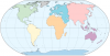 |
| HydroLAKES | Hydrography | Measured | HydroLAKES is a database aiming to provide the shoreline polygons of all global lakes with a surface area of at least 10 ha. | 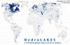 |
| HydroSHEDS | Hydrography | Modeled | Hydrological data and maps based on SHuttle Elevation Derivatives at multiple Scales. | |
| NHD | Hydrography | Measured | The National Hydrography Dataset | 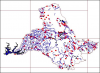 |
| North America 3 arcsec drainage area | Hydrography | Modeled | The drainage area of North America at 3 arc sec resolution, from 7°N, 55°W to 60°N, 142°W |  |
| North American River Width Data Set (NARWidth) | Hydrography | Measured | NARWidth is composed of planform morphometric measurements of North American rivers at approximately mean discharge | 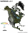 |
| SWBD | Hydrography | Measured | Shuttle Radar Topography Mission Water Body Dataset |  |
