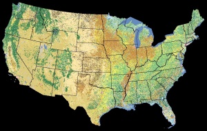
Data:NLCD 1992
NLCD 1992 dataset information page
Short Description
 |
| National Land Cover Dataset 1992 |
Statement: National Land Cover Dataset 1992
Abstract: Derived from the early to mid-1990s Landsat Thematic Mapper satellite data, the National Land Cover Data (NLCD) is a 21-class land cover classification scheme applied consistently over the United States. The spatial resolution of the data is 30 meters and mapped in the Albers Conic Equal Area projection, NAD 83. The NLCD are provided on a state-by-state basis. The state data sets were cut out from larger "regional" data sets that are mosaics of Landsat TM scenes. At this time, all of the NLCD state files are available for free download as 8-bit binary files and some states are also available on CD-ROM as a Geo-TIFF.
Data format
| Data type: | Land Cover |
| Data origin: | Modeled |
| Data format: | GeoTIFF |
| Other format: | |
| Data resolution: | 30meter |
| Datum: | NAD 83 |
Data Coverage
Spatial data coverage: USA
Temporal data coverage: Time snap shot
Time period covered: 1992
Availability
Download data: http://landcover.usgs.gov/natllandcover.php
Data source: http://landcover.usgs.gov/prodescription.php
