Data:GHSL
GHSL dataset information page
Short Description
 |
| Global Human Settlement Layer |
Statement: Global Human Settlement layer
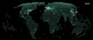
Abstract: The Global Human Settlement Layer (GHSL) project is supported by European Commission, Joint Research Center and Directorate-General for Regional and Urban Policy. The GHSL produces new global spatial information, evidence-based analytics, and knowledge describing the human presence in the planet. The GHSL relies on the design and implementation of new spatial data mining technologies allowing to process automatically and extract analytics and knowledge from large amount of heterogeneous data including: global, fine-scale satellite image data streams, census data, and crowd sources or volunteering geographic information sources. Spatial data reporting objectively and systematically about the presence of population and built-up infrastructures are necessary for any evidence-based modelling or assessing of i) human and physical exposure to threats as environmental contamination and degradation, natural disasters and conflicts, ii) impact of human activities on ecosystems, and iii) access to resources. The project produces thematic information and evidence-based analytical knowledge supporting the implementation of EU regional urban policy and the 4 international post-2015 frameworks, namely: Sustainable Development Goals, Global Urban Agenda, Climate Change and the Sendai Framework for Disaster Risk Reduction. Also, the project supports international scientific partnerships facilitating science-policy interface in the frame of the Group of Earth Observation (GI-21: Human Planet Initiative https://www.earthobservations.org/activity.php?id=51 ), and bi-lateral scientific collaborations with space agencies and scientific organizations of Brazil, China and South Africa. This data package contains an assessment of the REGIOOECD “degree of urbanization” model using as input the population GRID cells in four epochs (2015, 2000, 1990, and 1975).
Data format
| Data type: | Human dimensions |
| Data origin: | Measured |
| Data format: | GeoTIFF |
| Other format: | |
| Data resolution: | 1km |
| Datum: | World Mollweide (EPSG: 54009) |
Data Coverage
Spatial data coverage: Global
Temporal data coverage: Time series
Time period covered: 2015, 2000, 1990, and 1975
Availability
Download data: http://cidportal.jrc.ec.europa.eu/ftp/jrc-opendata/GHSL/GHS SMOD POP GLOBE R2016A/
Data source: http://ghsl.jrc.ec.europa.eu/
References
- Pesaresi, M., Huadong, G., Blaes, X., Ehrlich, D., Ferri, S., Gueguen, L., ... & Marin-Herrera, M. A. (2013). A global human settlement layer from optical HR/VHR RS data: concept and first results. IEEE Journal of Selected Topics in Applied Earth Observations and Remote Sensing, 6(5), 2102-2131.
