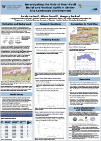
CSDMS 2016 annual meeting poster SarahHarbert
Investigating the role of near-fault relief and vertical uplift in strike-slip landscape development
Alison Duvall, University of Washington Seattle Washington, United States. aduvall@uw.edu
Gregory Tucker, University of Colorado - Boulder Boulder Colorado, United States. gtucker@colorado.edu
Abstract:
Strike-slip faults have long been observed to create distinctive fluvial landforms, such as offset, diverted, and captured streams, as well as near-fault relief features such as shutter ridges and sag ponds. These landforms, particularly offset streams, have been used to identify faults, assess fault activity and determine slip rates. However, not every active strike-slip fault shows a clear landscape signature of its presence, and strike-slip motion on a fault may not be wholly responsible for the occurrence and form of these features. Here, we attempt to constrain the factors that influence the production of strike-slip landforms. We use the Channel-Hillslope Integrated Landscape Development model (CHILD) to investigate specifically the effects of vertical uplift and relief across a fault. We model a scenario in which a strike-slip fault cuts a linear mountain ridge, offsetting a set of subparallel streams. By varying uplift rates and bedrock erodibility across the fault, we consider both how different ratios of vertical to horizontal fault motion affect the landscape and how the presence of landforms such as shutter ridges and sag ponds affect the development of the fluvial network along the fault, including stream offsets and capture events.
Of the parameters tested, relief on the downhill side of the fault has the strongest effect on the landscape. When relief is low and shutter ridges are very small or not present, offsets are very short and stream capture occurs frequently. As a consequence, drainage spacing remains short because long offsets do not cause adjacent drainages to merge. We compare these results to landscapes in the Marlborough Fault System of New Zealand, which is a suite of four parallel strike-slip faults that vary in slip rate from 3 to 20 mm/yr from north to south. At sites analogous to our models, relief on the downhill side of the fault broadly correlates to channel offset length. These results show that the presence of topography or lithologic contrasts that can enhance the landscape signature of a strike-slip fault. Pre-existing characteristics of the landscape may damp or exaggerate the production of stream offsets and the occurrence of stream captures.
* Please acknowledge the original contributors when you are using this material. If there are any copyright issues, please let us know and we will respond as soon as possible.
