CSDMS 2015 annual meeting poster MonicaStone
Quantifying the influence of land use/land cover change on inland flooding occurrence and severity following hurricane events using a physically-based hydrology-hydraulics model
Sagy Cohen, University of Alabama, Alabama, United States.
Abstract:
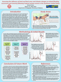
Tropical cyclones are the most severe rain events that impact the Southeast United States and often cause widespread flooding. These storms are the most costly weather hazards that occur in the United States, and the subsequent flooding is the leading cause of death from natural hazards in the United States. Most past research has focused on predicting storm surge following tropical cyclone events, but not much research has been conducted to study the affects of tropical cyclones on inland-river flooding in the Southeast United States, or how inland-river flooding following these storms is likely to change in the near future. Both the expected increase in tropical cyclone intensity with global climate warming, and future changes in land use/land cover are likely to alter flooding conditions following tropical cyclones. Here we present initial results from a study that aims to quantify the impact of increased precipitation, from tropical cyclone intensification, and changes in land use/land cover have on flooding magnitude and duration in 4 basins in the Southeast United States. This study utilizes the LISFLOOD model, a GIS hydrological rainfall-routing model, developed for flood forecasting and assessment of the effects of land use/land cover change and climate change on flooding conditions in a catchment. A sensitivity analysis was conducted using hypothetical land use/land cover scenarios in order to elucidate the influence of different land use/land cover types on tropical cyclone flooding magnitude and duration in the selected basins. Future efforts will focus on predicting hydrological conditions in the selected basins for 2100 given climate-induced tropical cyclone intensification, as well as possible land use/land cover change. The LISFLOOD model will be used again on the historical hydrological data for the selected basins: first just increasing precipitation rates during tropical cyclone events, second just changing the land use/land cover to that predicted for 2100, and third altering both the precipitation rates and the land use/land cover. While this research is still in progress, preliminary results suggest that tropical cyclone floods typically have a higher magnitude and a longer duration, and that this is likely to increase with both increased precipitation rates and increased urbanization in 2100. This study will help address the National Science Board’s call for a “[prediction of]… inland flooding from hurricanes and tropical storms,” and will hopefully help inform future mitigation and preparedness efforts.
* Please acknowledge the original contributors when you are using this material. If there are any copyright issues, please let us know and we will respond as soon as possible.

