All data
From CSDMS
All data descriptions
This is an automatically generated table.
Want to add your dataset to this list? Please complete this data form first. Feel free to contact us CSDMSweb@colorado.edu or use the wiki and follow one of the dataset links if you want to update the information about a dataset that is already listed.
There are 95 datasets described below.
| Dataset info | Type | Origin | Description | Data example |
|---|---|---|---|---|
| 3D Land Mapping | Land Cover | Measured | Combining Lidar and Radar for Remote Sensing of Land Surfaces | 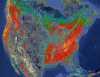 |
| A ~6km Daily Obserational Hydrometeorology data set, 1950-2013: North American Extent dataset | Climate | Measured | Daily Obserational Hydrometeorology data set: North American Extent | 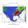 |
| AI&ML Challenge Dataset | Substrates | Measured | Machine Learning 'Challenge Dataset' for the Seabed |  |
| ASTER | Topography | Measured | Global topography from NASA's and METI's (Japan) Terra satellite |  |
| Aerial images Fraser GST | Topography | Measured | Aerial images of Fraser GST zone | 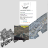 |
| African Sediment Yield Dataset | River discharge | Measured | Measured sediment yields of African rivers | 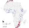 |
| AgeGrid | Substrates | Modeled | Age, Spreading Rates and Spreading Asymmetry of the World's Ocean Crust | 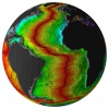 |
| CGIAR-CSI SRTM | Topography | Modeled | Improved and void-filled global topographic model of the SRTM data; 3 arc-second (~90 m) cell size | |
| Clara Orru - measured data of a degradational sand-gravel laboratory experiment | Topography | Measured | measured data from a degradational sand-gravel laboratory experiment |  |
| Coastal DEMs | Topography | Modeled | High-resolution, integrated bathymetric-topographic relief models of U.S. coastal communities; 1/3 arc-second (~10 m) cell size and coarser | 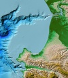 |
| DBSEABED | Substrates | Measured | dbSEABED Gridded Data Release: Gulf of Mexico | File:Gomex dbSBD CSDMS Aug2024.zip |
| DDM30 | Hydrography | Modeled | Global drainage direction map | |
| Dartmouth Flood Observatory | River discharge | Measured | Dartmouth Flood Observatory: Space-based Measurement of Surface Water | |
| E-OBS | Climate | Measured | E-OBS is a daily gridded observational dataset for precipitation and temperature in Europe based on ECA&D information. | 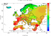 |
| ERA5 | Climate | Modeled | ERA5 is the fifth generation ECMWF reanalysis for the global climate and weather for the past 8 decades. Data is available from 1940 onwards. ERA5 replaces the ERA-Interim reanalysis. |  |
| ETOPO1 | Topography | Modeled | Global integrated bathymetric-topographic relief model; 1 arc-minute (~2 km) cell size | 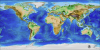 |
| Experimentalist Data Catalog | Surface properties | Measured | Experimental datasets offered by the Sediment Experimentalist Network | 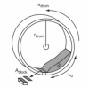 |
| GEBCO | Topography | Modeled | Global integrated bathymetric-topographic relief model; 1 arc-minute (~2 km) and 30 arc-second (~1 km) cell sizes |  |
| GHSL | Human dimensions | Measured | Global Human Settlement layer | |
| GIMMS | Land Cover | Measured | Global Inventory Modeling and Mapping Studies (GIMMS) |  |
| GLC-SHARE | Land Cover | Measured | Global Land Cover-SHARE (GLC-SHARE) provides access to an assembled product of global land cover. |  |
| GLOBALSOD | Climate | Measured | NOAA Daily Global Summary of Day (GLOBALSOD) Station Data |  |
| GLOBE | Topography | Measured | Global topographic relief model; 30 arc-second (~1 km) cell size |  |
| GLiM | Surface properties | Measured | Global Lithological Map |  |
| GMIA | Human dimensions | Measured | Global Map of Irrigation Areas (version 5.0) | |
| GPW | Human dimensions | Modeled | Gridded Population of the World | |
| GRDC | River discharge | Measured | Glocal Runoff Data Centre |  |
| GSHAP | Surface properties | Measured | Global Seismic Hazard Assessment Program | |
| GSHHG | Topography | Measured | Global Self-consistent, Hierarchical, High-resolution Geography Database |
 |
| GTOPO30 | Topography | Measured | GTOPO30 is a global digital elevation model with a horizontal resolution of 30 arc seconds. | 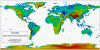 |
| Geomaterials Vocab | Substrates | Measured | A Structured Vocabulary for Geomaterials |  |
| Geomorpho90m | Land Cover | Measured | A global dataset comprising of different geomorphometric features derived from the MERIT-Digital Elevation Model (DEM) - the best global, high-resolution DEM available. | |
| GlobCover | Land Cover | Measured | Global Land Cover Map | |
| Global Cropland Area (1960-2100) | Land Cover | Modeled | Global Cropland Area predictions by the GLUDM model | 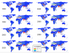 |
| Global Forest Heights | Land Cover | Measured | Forest canopy height globally with spaceborne lidar | 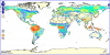 |
| Global Multibeam Bathymetry | Topography | Measured | NGDC's global database of multibeam swath sonar bathymetric surveys |  |
| Global River and Delta Systems | River discharge | Measured | Global River and Delta Systems |  |
| Global Topography | Topography | Modeled | Global estimated bathymetric and integrated bathy-topo relief models; 1 minute (~2 km) and 30 arc-second (~1 km) cell sizes |  |
| Great Bay, NH - BBL Data June 2011 | Oceanography | Measured | Fine resolution bottom boundary layer velocity measurements in a tidal estuary |  |
| Great Lakes Bathymetry | Topography | Modeled | Bathymetric models and contours of the Great Lakes; 3 arc-second (~90 m) cell size |  |
| HWSD | Surface properties | Measured | Harmonized World Soil Database (HWSD) | |
| HYDAT | River discharge | Measured | HYDAT - Online access to historical water levels, streamflow and sediment data of Canada |  |
| HYDRO1k | Hydrography | Modeled | HYDRO1k is a geographic database providing comprehensive and consistent global coverage of optographically derived data sets. |  |
| Hooshmand etal JGR2015 | Oceanography | Measured | Wave-supported mud layer laboratory data |  |
| HydroLAKES | Hydrography | Measured | HydroLAKES is a database aiming to provide the shoreline polygons of all global lakes with a surface area of at least 10 ha. | 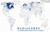 |
| HydroSHEDS | Hydrography | Modeled | Hydrological data and maps based on SHuttle Elevation Derivatives at multiple Scales. | |
| IBCAO | Topography | Modeled | Integrated bathymetric-topographic relief model of the Arctic Ocean; 500-meter cell size | 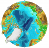 |
| ICE-5G | Cryosphere | Modeled | Global Grids of Ice Sheet Thickness and Paleotopography for 21,000 - present day | 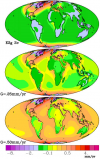 |
| IEDA data services for observational Geoscience data | Oceanography | Measured | IEDA or Integrated Earth Data Applications provides data services for observational Geoscience data from the Ocean, Earth, and Polar Sciences | 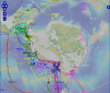 |
| LUSoils v.1 | Land Cover | Modeled | Linking global land use and land cover to hydrologic soil groups from 850 to 2015. |  |
| MERIT DEM | Topography | Measured | The MERIT DEM was developed by removing multiple error components from existing spaceborne DEMs (SRTM3 and AW3D) |  |
| MLD | Oceanography | Measured | Ocean mixed layer depth climatology |  |
| Marine Geophysical Trackline Data | Topography | Measured | NGDC's global database of marine trackline surveys; contains bathymetry, magnetics, gravity and seismic navigation data |  |
| Modeled Suspended Sediment in Global Rivers | River discharge | Modeled | Modeled Global Suspended Sediment Flux |  |
| NCED data repository | Surface properties | Measured | Data from or related to the National Center for Earth-surface Dynamics (NCED) |  |
| NED | Topography | Modeled | U.S. National Elevation Dataset (NED) topographic relief model; 1/9 arc-second (~3 m) cell size to 2 arc-second (~60 m) cell size |  |
| NGDC Coastal Relief Model | Topography | Modeled | Integrated bathymetric-topographic relief models of U.S. coasts; 3 arc-second (~90 m) cell size |  |
| NHD | Hydrography | Measured | The National Hydrography Dataset |  |
| NLCD 1992 | Land Cover | Modeled | National Land Cover Dataset 1992 | 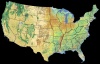 |
| NLCD 2001 | Land Cover | Modeled | National Land Cover Database of 2001 |  |
| NOSHDB | Topography | Measured | Database of U.S. hydrographic surveys conducted by NOAA's National Ocean Service | 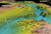 |
| NRLP India | River discharge | Modeled | Proposed canals and dams data for the Indian Rivers Interlinking project | 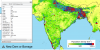 |
| NWIS | River discharge | Measured | National Water Information System (NWIS) |  |
| National Climatic Data Center HDSS Access System | Climate | Measured | Access portal for US weather radar data, satellite data, and additional (US and international) historical weather forecasts and data |  |
| Nearshore Oceanographic Observations at Drew Point, Alaska, Summers 2009 and 2010 | Oceanography | Measured | Nearshore Oceanographic Observations at Drew Point, Alaska, Summers 2009 and 2010 |  |
| North America 3 arcsec drainage area | Hydrography | Modeled | The drainage area of North America at 3 arc sec resolution, from 7°N, 55°W to 60°N, 142°W |  |
| North American River Width Data Set (NARWidth) | Hydrography | Measured | NARWidth is composed of planform morphometric measurements of North American rivers at approximately mean discharge | 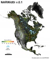 |
| OSCAR | Oceanography | Measured | Ocean Surface Current Analyses - Real time | |
| OneGeology | Substrates | Modeled | Datawarehouse to create a digital geological map of the world |  |
| OpenTopography | Topography | Modeled | Community access to high-resolution, Earth science-oriented, topography data, and related tools and resources. |  |
| PMIP 2 | Climate | Modeled | Output from the second Paleoclimate Modeling Intercomparison Project | |
| PSMSL | Sea level | Measured | Permanent Service for Mean Sea Level (PSMSL) |  |
| Permafrost Temperatures, Alaska | Cryosphere | Measured | U.S. Geological Survey's Borehole Temperature Logs from Arctic Alaska, pre-1989 | 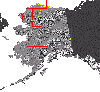 |
| R-ArcticNet | River discharge | Measured | R-ArcticNet (v4.0) - A Regional, Electronic, Hydrographic Data Network For the Arctic Region |  |
| RESSED | Surface properties | Measured | The Reservoir Sedimentation Database |  |
| Realtime Permafrost Alaska | Cryosphere | Measured | U.S. Geological Survey: Real-Time Permafrost and Climate Monitoring Network - Arctic Alaska | 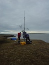 |
| ReefBase | Oceanography | Measured | A global information system for coral reefs | 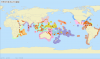 |
| SRTM | Topography | Measured | Global topography from NASA's 2000 Shuttle Radar Topography Mission (SRTM) |  |
| SSURGO | Surface properties | Measured | SSURGO (Soil Survey Geographic database) refers to digital soils data produced and distributed by the Natural Resources Conservation Service (NRCS) - National Cartography and Geospatial Center (NCGC). | 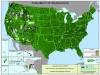 |
| STATSGO | Surface properties | Measured | The U.S. General Soil Map | 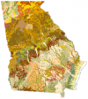 |
| SWBD | Hydrography | Measured | Shuttle Radar Topography Mission Water Body Dataset |  |
| Sage | River discharge | Measured | Global River Discharge Database |  |
| Sea Ice Concentrations NSIDC | Cryosphere | Measured | Sea Ice Concentrations from Nimbus-7 SMMR and DMSP SSM/I Passive Microwave Data |  |
| Sediment Thickness of worlds oceans | Oceanography | Measured | Total Sediment Thickness of the World's Oceans & Marginal Seas |  |
| SoilGrids — global gridded soil information | Surface properties | Measured | SoilGridsTM is a system for global digital soil mapping that uses state-of-the-art machine learning methods to map the spatial distribution of soil properties across the globe. | |
| Southern Alaska Coastal Relief Model | Topography | Modeled | Integrated bathymetric-topographic relief model of Southern Alaska; 24 arc-second cell size | |
| TPXO6.2 | Oceanography | Modeled | Global Inverse Tide Model | 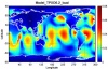 |
| TRMM | Climate | Measured | Tropical Rainfall Measuring Mission | |
| UNPD | Human dimensions | Modeled | United Nations Population Database (1950 - 2050) | 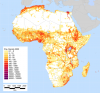 |
| WaveWatch III^TM | Oceanography | Modeled | WAVEWATCH III™ (Tolman 1997, 1999a, 2009) is a third generation wave model developed at NOAA/NCEP in the spirit of the WAM model (WAMDIG 1988, Komen et al. 1994). Simulation results contain waves & swells Hs, direction, period, wind direction, etc. | 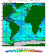 |
| World Glacier Inventory | Cryosphere | Measured | Information on glaciers for over 100,000 glaciers through out the world served by the National Snow and Ice Data Center | 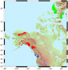 |
| World Ocean Atlas 2001 | Oceanography | Measured | World Ocean Atlas 2001 (WOA01) |  |
| World Ocean atlas | Oceanography | Measured | World Ocean Atlas 2009 |  |
| World River Sediment Yields Database | River discharge | Measured | This database contains data on annual sediment yields in worldwide rivers and reservoirs, searchable by river, country and continent. |  |
| World Vector Shoreline | Topography | Measured | World Vector Shoreline |  |
