File:Figure 1.png
From CSDMS
Revision as of 12:10, 30 August 2011 by Bfekete (talk | contribs) (Daily water balance/transport simulations of the Danube river basin at 6' resolution (in geographical coordinate space) were carried out using high resolution precipitation forcings from CMORPH (at 15' spatial resolution) and GPCC 1dd (60' resolution abov)
Size of this preview: 800 × 505 pixels. Other resolution: 940 × 593 pixels.
Original file (940 × 593 pixels, file size: 76 KB, MIME type: image/png)
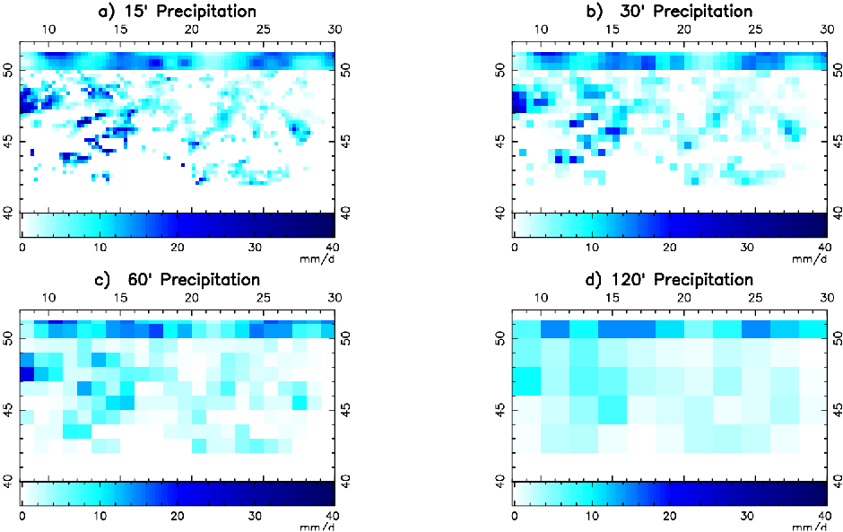
Daily water balance/transport simulations of the Danube river basin at 6' resolution (in geographical coordinate space) were carried out using high resolution precipitation forcings from CMORPH (at 15' spatial resolution) and GPCC 1dd (60' resolution above 50 degree North that CMORPH does not cover). The affect of the spatial resolution of the forcing data was tested by spatially aggregating CMPORP/GPCC 1dd to 30', 60' and 120' resolution.
File history
Click on a date/time to view the file as it appeared at that time.
| Date/Time | Thumbnail | Dimensions | User | Comment | ||
|---|---|---|---|---|---|---|
| delete all | current | 12:10, 30 August 2011 | | 940 × 593 (76 KB) | Bfekete (talk | contribs) | Daily water balance/transport simulations of the Danube river basin at 6' resolution (in geographical coordinate space) were carried out using high resolution precipitation forcings from CMORPH (at 15' spatial resolution) and GPCC 1dd (60' resolution abov |
You cannot overwrite this file.
File usage
There are no pages that use this file.
