Land cover data descriptions
This is an automatically generated table.
Want to add your dataset to this list? Please complete this data form first. Feel free to contact us CSDMSweb@colorado.edu or use the wiki and follow one of the dataset links if you want to update the information about a dataset that is already listed.
There are 10 datasets described below.
| Dataset info | Type | Origin | Description | Data example |
|---|---|---|---|---|
| 3D Land Mapping | Land Cover | Measured | Combining Lidar and Radar for Remote Sensing of Land Surfaces | 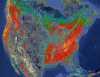 |
| GIMMS | Land Cover | Measured | Global Inventory Modeling and Mapping Studies (GIMMS) | 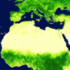 |
| GLC-SHARE | Land Cover | Measured | Global Land Cover-SHARE (GLC-SHARE) provides access to an assembled product of global land cover. | 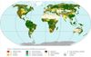 |
| Geomorpho90m | Land Cover | Measured | A global dataset comprising of different geomorphometric features derived from the MERIT-Digital Elevation Model (DEM) - the best global, high-resolution DEM available. | |
| GlobCover | Land Cover | Measured | Global Land Cover Map | |
| Global Cropland Area (1960-2100) | Land Cover | Modeled | Global Cropland Area predictions by the GLUDM model | 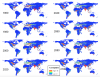 |
| Global Forest Heights | Land Cover | Measured | Forest canopy height globally with spaceborne lidar | 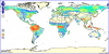 |
| LUSoils v.1 | Land Cover | Modeled | Linking global land use and land cover to hydrologic soil groups from 850 to 2015. | 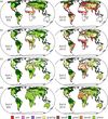 |
| NLCD 1992 | Land Cover | Modeled | National Land Cover Dataset 1992 | 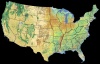 |
| NLCD 2001 | Land Cover | Modeled | National Land Cover Database of 2001 | 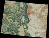 |
