File:Poverty Bay bever.png
From CSDMS
Size of this preview: 670 × 599 pixels. Other resolutions: 859 × 768 pixels | 1,163 × 1,040 pixels.
Original file (1,163 × 1,040 pixels, file size: 3.31 MB, MIME type: image/png)
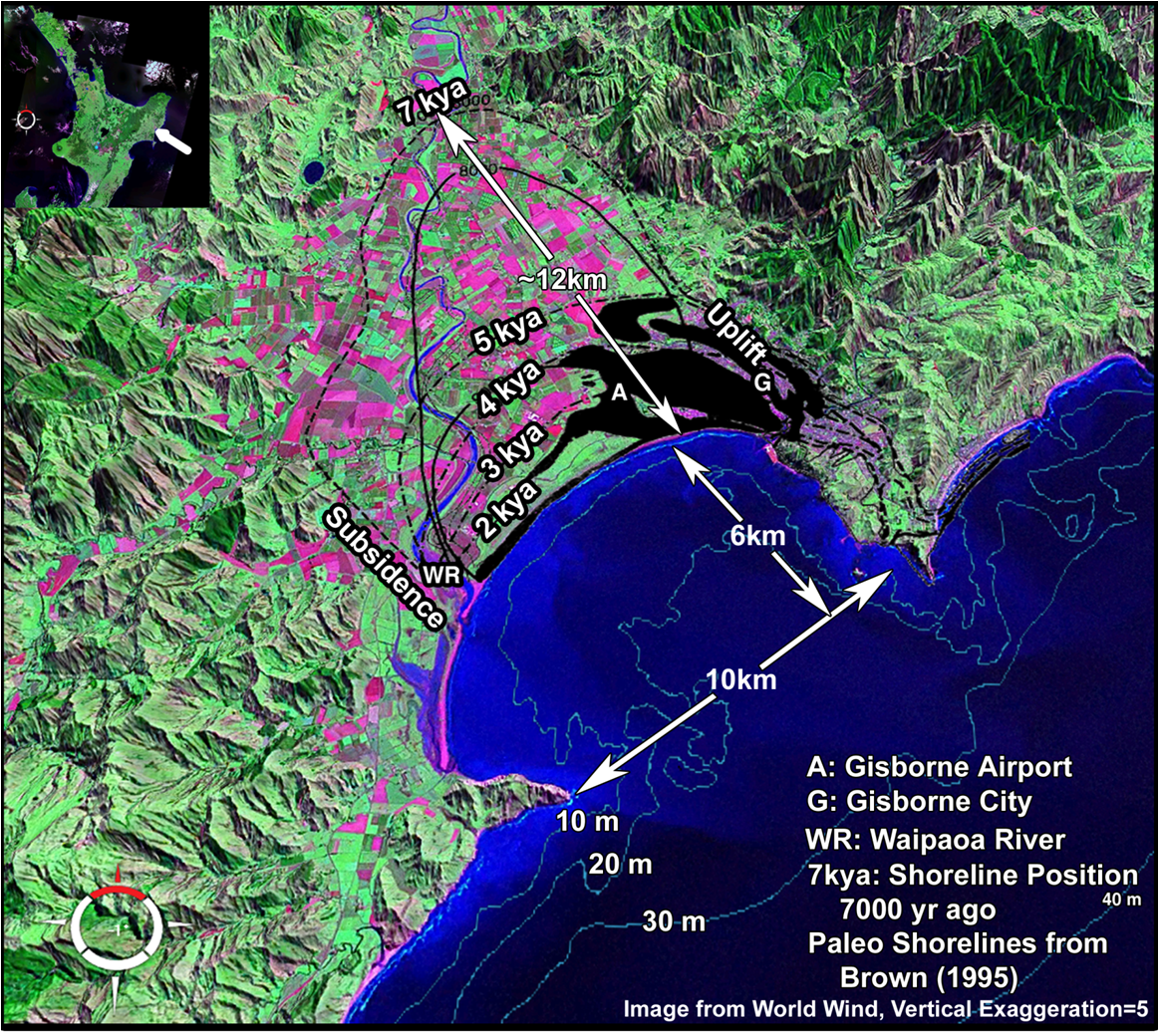
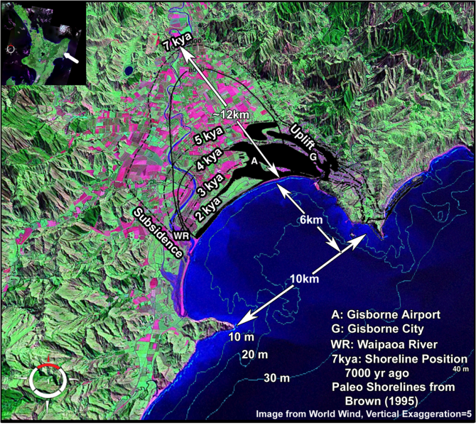
This is a satellite image figure from World Wind with Poverty Bay shorelines through time (from Brown 1995) overlain on the image. The text highlights shoreline locations, etc.
File history
Click on a date/time to view the file as it appeared at that time.
| Date/Time | Thumbnail | Dimensions | User | Comment | ||
|---|---|---|---|---|---|---|
| delete all | current | 12:39, 5 November 2010 | | 1,163 × 1,040 (3.31 MB) | Abever (talk | contribs) | This is a satellite image figure from World Wind with Poverty Bay shorelines through time (from Brown 1995) overlain on the image. The text highlights shoreline locations, etc. |
You cannot overwrite this file.
File usage
The following page uses this file:
